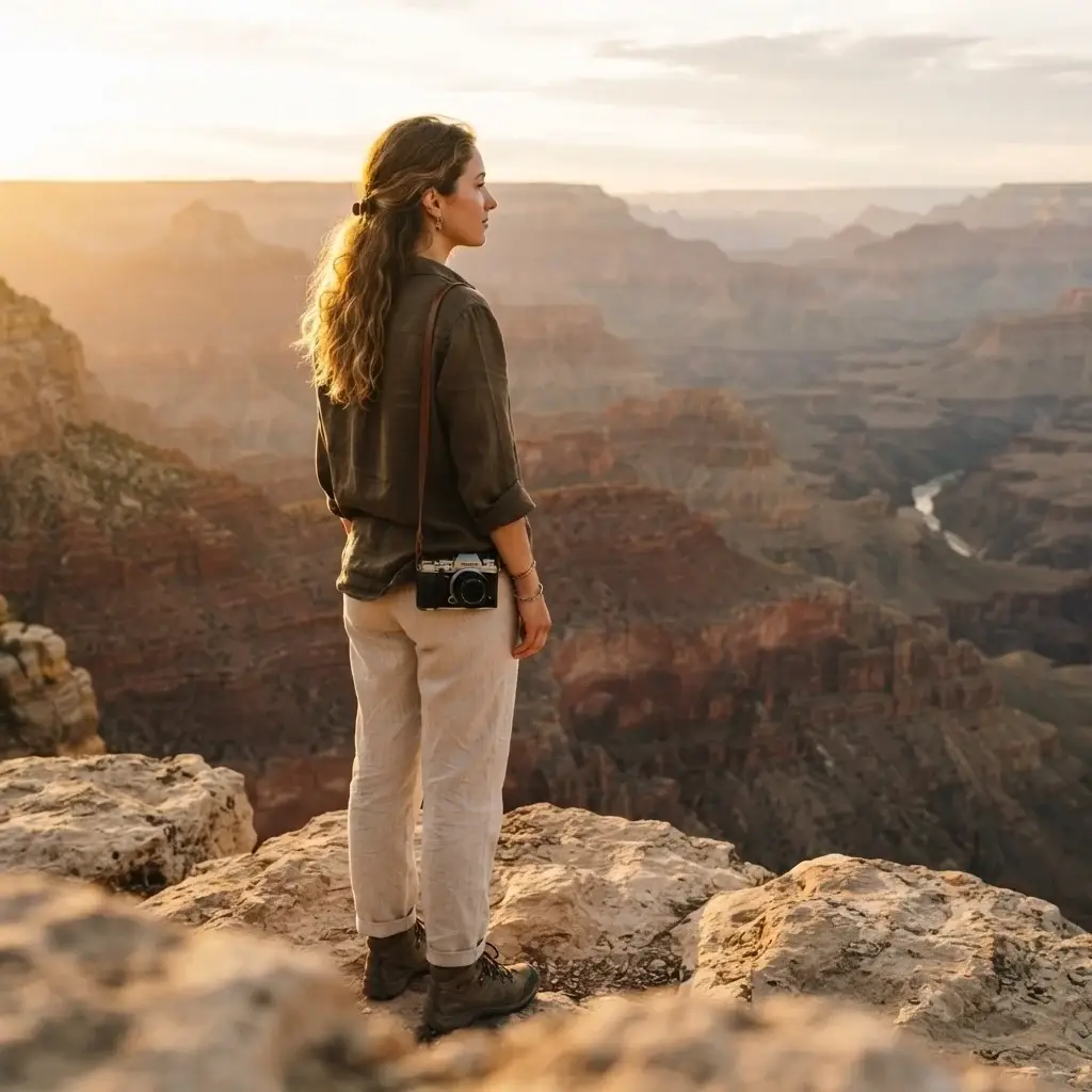
The first time I really understood what canyons do to people, I wasn’t standing inside one. I was talking to a solo traveler in a hostel common room during my backpacking trip through Europe. She had just come back from the American Southwest and she couldn’t stop talking. Not about the distance she covered or the photos she got. She kept saying, “I just felt so small, and that felt so right.”
That landed with me. Because that’s not something you get from a city break or a beach resort. That’s something that only happens when you’re deep inside the earth itself, surrounded by rock walls that have been carved by water and time over millions of years.
The Americas are home to some of the most jaw-dropping canyon landscapes on the planet, and most people only know about one or two of them. The Grand Canyon gets all the headlines, but there’s an entire continent worth of canyon hikes waiting, from the depths of Peru to the deserts of northern Mexico to a volcanic island in Hawaii. Some of these places will genuinely reframe the way you think about your own place in the world.
This guide is for you if you’ve been thinking about a canyon hike but aren’t sure where to start, which ones are accessible for a solo traveler, or how to plan without making the most common mistakes. Let’s get into it.
What Makes Canyon Hiking Different (And Why That Matters Before You Go)
Before we get into specific destinations, there’s something important to understand about canyon hiking that most generic listicles skip entirely: it’s not like hiking a mountain.
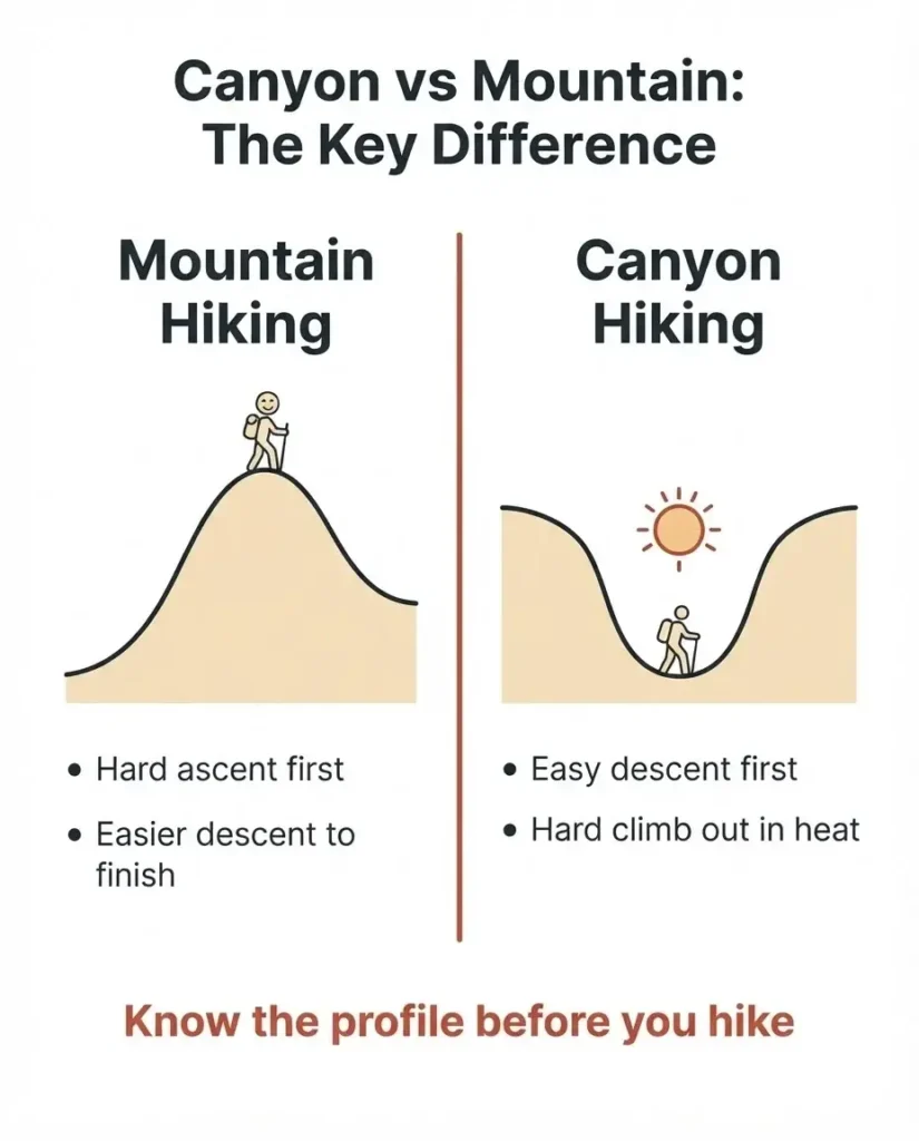
When you hike a mountain, you go up hard and come down tired but relieved. A canyon inverts that completely. You descend first, often in the cool morning air, feeling strong and capable. The ascent back out is what breaks you, usually in full midday heat with most of your water already gone. This catch is so well-known at the Grand Canyon that the park literally posts signs warning visitors not to hike down what they cannot hike back up.
This is not said to scare you. I’m a firm believer that more people can handle more challenging adventures than they give themselves credit for. But going in without understanding the “reverse hike” dynamic is how people end up needing rescue on trails they thought looked easy on paper. Know the profile, plan accordingly, and you’ll be fine.
Beyond physical logistics, canyon hiking carries a cultural and spiritual weight that good hikers learn to respect. Many of the canyons in the Americas were and continue to be sacred to Indigenous peoples. Many are landscapes carved by civilizations that predate written European history by centuries. That context matters. It changes the experience from sightseeing to something more meaningful.
The Grand Canyon, Arizona: The Standard, and Still Extraordinary
There’s a reason everyone talks about the Grand Canyon. No photograph does it justice, and no description really prepares you. At 277 miles long, up to 18 miles wide, and over a mile deep, it’s a scale that your brain genuinely struggles to process when you first look out over the rim.
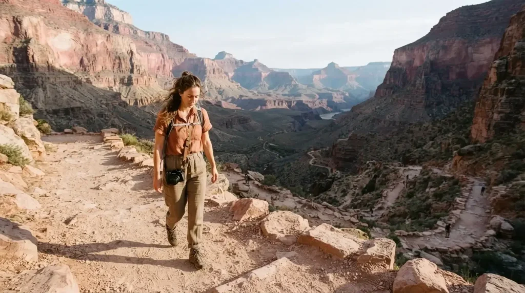
For solo hikers visiting the South Rim, the two trails most worth your time are Bright Angel Trail and the South Kaibab Trail. Bright Angel is forgiving, with two rest houses that have water available in the warmer months, making it the more practical choice for day hikes going below the rim. South Kaibab has no water but rewards you with open ridgeline views that Bright Angel’s sheltered corridor can’t match. The classic solo strategy: descend South Kaibab to Ooh Aah Point or Cedar Ridge, return along Bright Angel.
The entry fee is $35 per vehicle (valid seven days) or $20 per person if you arrive on foot or by bike. One important note for international readers: as of July 2025, non-US residents aged 16 and older now pay an additional $100 per person fee on top of the standard entry, unless they hold an Annual or America the Beautiful Pass. The park does not accept cash at any entrance station, so make sure you have a card. You can check the current fee structure and plan your visit directly on the Grand Canyon National Park fees page.
Also worth noting: the North Rim is closed for the 2025 season due to fire damage. Plan for the South Rim and build in extra time, because this place deserves at least two full days, not a rushed afternoon.
What to eat: In the canyon area, pick up a hearty breakfast burrito from the Bright Angel Bicycles and Cafe near the visitor center before you head out. If you’re in Tusayan, the small gateway town just outside the south entrance, the Canyon Star Restaurant serves solid Southwestern food that feels appropriate after a big hike.
The thing solo travelers love most about Grand Canyon is that you are never truly alone on the main trails, but you also have plenty of quiet if you start early. The trail traffic drops dramatically if you’re on the path by 7 a.m.
Zion National Park, Utah: Walking Through the Virgin River
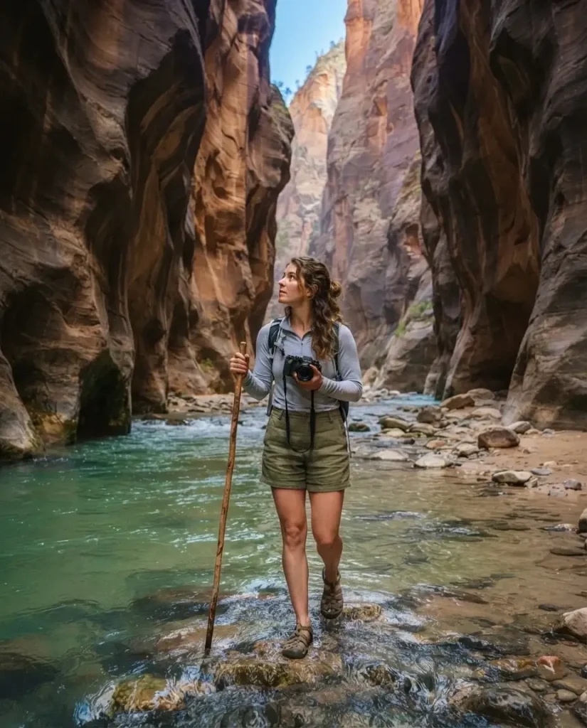
Zion Canyon isn’t as deep as the Grand Canyon, but hiking inside it feels even more dramatic in a different way. The canyon walls tower nearly 2,500 feet above the canyon floor, and because they’re so close together, you spend much of your time in a narrow corridor of pink and red Navajo sandstone with the sky appearing as just a thin ribbon above you.
The hike that captures this feeling most purely is The Narrows. You hike directly in the Virgin River, literally walking upstream through the water between walls that in some places are only 20 to 30 feet apart. The water is cold, the light is otherworldly, and the whole experience feels less like hiking and more like wandering through the inside of a cathedral.
The good news for solo travelers is that you don’t need any permit to do the most popular Narrows route, the bottom-up walk from the Temple of Sinawava trailhead. You simply enter the park, pay the entrance fee (also $35 per vehicle), take the free park shuttle to the end of the road, and start walking upstream. The full permit situation at Zion is a bit more complex if you want to do the longer top-down through-hike or other technical routes, and the official Zion permits and reservations page breaks down exactly what requires what.
One practical tip: Zion’s free shuttle system is mandatory for the main canyon during peak season (roughly late spring through early fall). You cannot drive your own car to the trailheads during this period. That’s fine. The shuttles run frequently and the system is easy. Just don’t plan to arrive at 10 a.m. on a Saturday in July and expect a smooth experience. Either get there before 8 a.m. or after 3 p.m.
What to eat: The town of Springdale, right at the park’s south entrance, has genuinely good food. MeMe’s Cafe does excellent breakfasts. Spotted Dog Cafe is popular for dinner. Stock up on snacks in town before you head in, since there’s no food inside the canyon itself.
Zion is also exceptional for solo travelers because the hiking community here is warm and social. From what solo travelers consistently report, it’s one of the easier parks in the US for meeting fellow hikers and potentially pairing up for the longer routes.
Antelope Canyon, Arizona: Where Light Becomes the Trail
Antelope Canyon sits on Navajo Nation land near Page, Arizona, and it occupies a completely different category from the other canyon hikes in this article. It’s a slot canyon, meaning a narrow, winding passage carved by flash floods through the sandstone, sometimes barely wide enough for two people to pass each other.
You cannot hike Antelope Canyon independently. All visits are through guided tours operated by licensed Navajo guides, and this is not bureaucratic red tape. It’s meaningful. The canyon is sacred Navajo land, and the requirement to visit with a Navajo guide ensures that the site is managed by the people it belongs to, while also keeping you safe in terrain where flash flooding remains a genuine risk. The entry fee is $15 per person, in addition to the tour cost. The Navajo Nation Parks official tour operators page lists all authorized companies for both Upper and Lower Antelope Canyon.
Upper Antelope Canyon is the one famous for those stunning light beam photographs. Lower Antelope Canyon is less crowded, in my view more interesting structurally, and requires a bit more physical navigation since you descend via ladders. Both are worth it.
Go in late morning if light beams matter to you. From roughly March through October, the sun angle around midday sends pillars of light down through the canyon opening, and the effect is genuinely surreal.
Colca Canyon, Peru: Two Miles Straight Down
Here’s a fact that surprises almost everyone: Colca Canyon is roughly twice the depth of the Grand Canyon. At approximately 3,270 meters deep from rim to its deepest point, it is one of the deepest canyons on Earth, second in South America only to the neighboring Cotahuasi Canyon.
The most popular trekking route descends from the village of Cabanaconde into the canyon and takes two to three days round trip, with an overnight stay in the oasis of Sangalle at the bottom, where there are small guesthouses and natural pools. It’s a stunning experience: you hike down through terraced agricultural land built by pre-Inca civilizations, cross a suspension bridge over the Colca River, and sleep in one of the most remote and peaceful places imaginable.
The canyon is managed by AUTOCOLCA, Peru’s official autonomous authority for the Colca region, and all visitors must purchase an entrance ticket. The current foreign adult price is S/70 (approximately $18-19 USD). You buy it at any checkpoint and need to keep it for the duration of your visit. Check AUTOCOLCA’s official site for any updated ticketing information before you go.
A few things first-time visitors consistently underestimate: the altitude. Cabanaconde sits at around 3,287 meters above sea level. If you’ve just arrived from Lima or another low-altitude city, you will feel the altitude. Give yourself at least a day in Arequipa (around 2,335 meters) to acclimatize before attempting the descent. And don’t forget that while hiking down feels manageable, climbing back out takes most people three to four hours of serious effort.
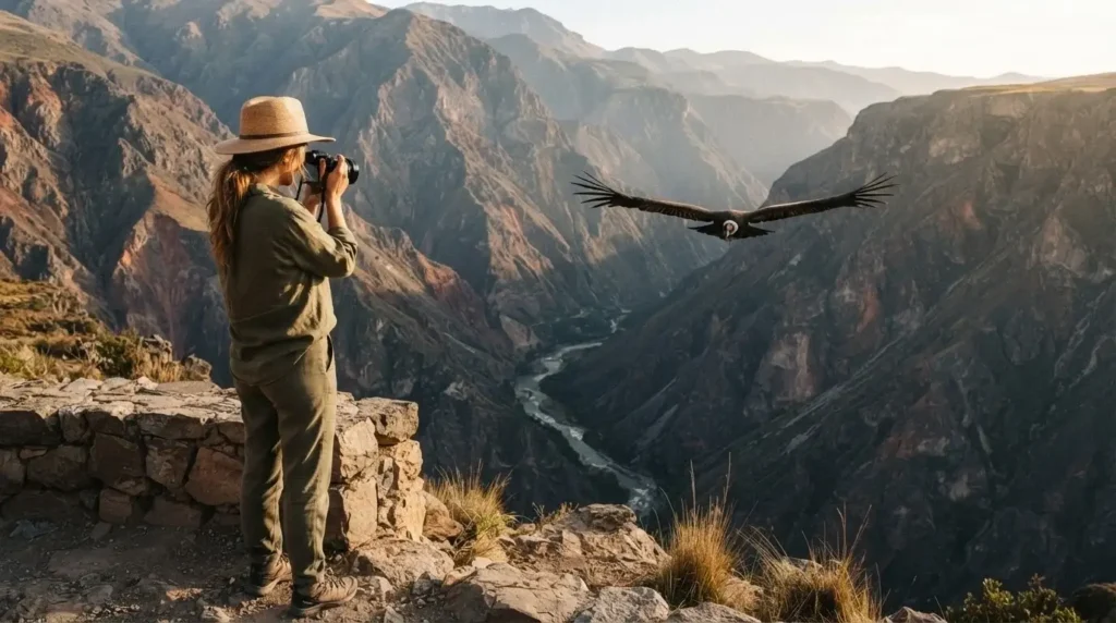
The condor sighting at Cruz del Condor viewpoint, about 14 km from Chivay on the canyon rim, is genuinely spectacular. Andean condors are among the largest flying birds on Earth, with wingspans up to 3 meters, and they use the canyon’s thermal updrafts to soar. Arrive before 9 a.m. for the best sightings.
What to eat: In Chivay, the main town near the canyon, try rocoto relleno (a spicy stuffed pepper, a classic Arequipa regional dish) and sopa de quinoa (quinoa soup). Simple, hearty, and exactly what you want after a long day at altitude.
Solo travelers do this hike independently all the time.
The trail is reasonably well-marked between Cabanaconde and Sangalle. That said, hiring a local guide for the descent adds context about the agricultural terraces and local Collagua culture that you genuinely can’t get from a map.
Copper Canyon, Mexico: Bigger Than the Grand Canyon
Most people who hear “Copper Canyon” for the first time are surprised it exists, and then surprised again when they learn it’s actually larger in total area than the Grand Canyon. Located in the Sierra Madre Occidental in the state of Chihuahua, Barrancas del Cobre (Copper Canyon) is a system of six interconnected canyons carved by four rivers, covering an area of roughly 65,000 square kilometers.
The canyon walls take on a copper and green hue when wet, which is where the name comes from. The region is also home to the Rarámuri (Tarahumara) people, an Indigenous community famous for their extraordinary long-distance running ability, still living traditional lives in the canyon communities.
The best way to approach this region is by the El Chepe train, one of the great train journeys in the Americas. It runs 673 kilometers from Chihuahua City on the high plateau down to Los Mochis on the Pacific coast, passing through 37 bridges and 86 tunnels as it descends through the canyon system. The train allows you to hop off at Divisadero or Bahuichivo for hiking and exploration, then continue on the next day. You can book tickets and check schedules directly on the official Chepe Express website.
For hikers, the route from Cusarare to Divisadero (about 32 miles, three to four days) is deservedly famous. Trailheads are accessible from Creel, the main backpacker hub for the region. Creel has guesthouses, a few good restaurants, and guides who know the terrain
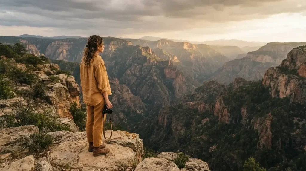
and can introduce you to Rarámuri communities along the way.
What to eat: In Creel, look for pozole (a hearty corn and meat stew) and grilled meats from the local parrillas. The region also produces excellent local cheese. This is northern Mexico, so don’t expect the same cuisine you’d find in Oaxaca. It’s simpler, heartier mountain cooking.
Is Copper Canyon safe? From what solo travelers consistently report, Creel and the main canyon corridor are reasonably comfortable to navigate. As with anywhere, research current conditions before you go, travel in daylight, and connect with your guesthouse for local advice on trail conditions and route changes.
Quebrada de Humahuaca, Argentina: Ancient Colors and Andean Culture
If you want canyon hiking that also doubles as one of the most culturally layered landscapes in South America, the Quebrada de Humahuaca in northwestern Argentina belongs on your list. This narrow, arid mountain valley in the province of Jujuy was designated a UNESCO World Heritage Site in 2003 for its role as a cultural crossroads over 10,000 years of human history, from pre-Inca civilizations through the Spanish colonial era to Argentine independence.
The colors of the canyon walls here are extraordinary: seventeen distinct geological strata in shades of red, yellow, violet, and green that shift throughout the day as the light changes. The most famous viewpoint is the Serranias del Hornocal (Hill of Fourteen Colors), accessed by a rough road from Humahuaca town, with a short walk to the mirador.
The main towns of Tilcara and Humahuaca serve as excellent bases. Both have small markets selling local textiles, empanadas (the baked, potato-and-meat filled version typical of the northwest), locro (a thick Andean stew of corn, beans, and meat), and excellent purple maize chicha if you want to try it.
The hiking here is less about technical trails and more about wanders through Quechua-speaking villages, pre-Columbian ruins called pucaras, and landscapes that feel entirely different from anything in North America. Tilcara’s Pucara archaeological site is a short walk from town and gives significant historical grounding before you explore further.
Getting here: Salta is the main gateway city, with regular buses running up the Quebrada. The whole valley is relatively affordable by South American standards.
Waimea Canyon, Kauai, Hawaii: The Grand Canyon of the Pacific
Waimea Canyon on the island of Kauai earns its nickname honestly. At 14 miles long, 1 mile wide, and 3,600 feet deep, it’s not in the same scale as the Grand Canyon, but the combination of volcanic rock in deep reds, the lush green vegetation clinging to every ledge, and the occasional rainbow hanging over the canyon floor creates a visual experience that’s completely unlike anything on the mainland.
The best hike for solo travelers is the Canyon Trail to Waipoo Falls, a 3.8-mile round trip with about 1,000 feet of elevation change, passing through native forest before arriving at the top of a waterfall with canyon views that warrant genuine silence. The trail can be muddy, especially in the rainy season (October through April), so waterproof hiking shoes aren’t optional here.
The park is managed by Hawaii’s Division of State Parks (DLNR). On the Hawaii DLNR Kauai trails page, you can find current trail conditions, closures, and access information before you visit. Note that as of mid-July 2025, the park issued a notice about parking delays and limited parking at Waimea Canyon and Kokee State Parks, so arriving early and being flexible with your timing is especially smart.
What to eat: Drive back to Waimea town for shave ice and plate lunch from local spots. Kauai also has incredible fresh fish, and the poke bowls on this island are among the best in Hawaii.
Planning Your Canyon Hike: The Practical Stuff That Matters
No matter which canyon you choose, a few principles hold true across all of them.
Start early, always. Canyon hiking in the heat is not just uncomfortable, it’s genuinely dangerous. Most of the rescue situations at Grand Canyon and Zion happen to people who started their descent at 10 or 11 a.m. The trail is a completely different experience at 6:30 a.m. Cooler, quieter, and the light is extraordinary.
Water is non-negotiable. The general rule for canyon hiking is at least one liter of water per hour in hot conditions. A water filter or purification tablets give you flexibility if there are water sources on the trail (as there are on some routes in Colca Canyon and Copper Canyon).
Know the permit situation before you arrive. Nothing derails a planned hike faster than arriving at a trailhead and discovering you needed a reservation three months ago. I always spend 20 minutes on the official park or authority website before booking my flights, not after.
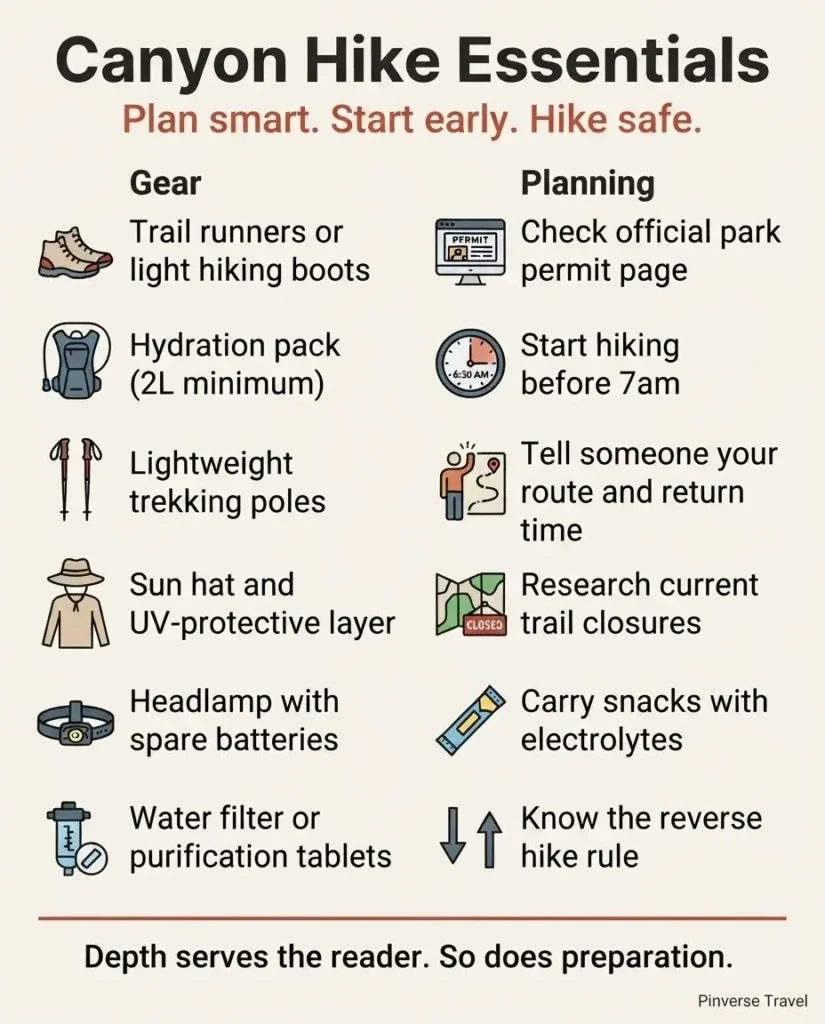
Footwear matters more than almost anything else. A trail runner or light hiking boot with ankle support is appropriate for most trails here. For the Narrows at Zion, the park’s own shuttle stop at the Temple of Sinawava has a gear rental kiosk where you can pick up neoprene socks and canyoneering sandals, which make a cold-water hike genuinely comfortable.
Tell someone your plan. This is the thing I wish more solo hikers would take seriously. Before any significant canyon hike, text a friend your trailhead, your planned route, and a “check in by” time. It costs you 30 seconds and it matters.
A Final Thought
When I was working as a sightseeing guide in New York City, my job was to show people a landscape and tell them its story. I learned pretty quickly that the places that stayed with people weren’t always the biggest or most famous. They were the ones where the person felt something shift. A moment where the scale of the world made them recalibrate their sense of what was possible.
Canyon hikes in the Americas do that. Almost every time.
You don’t need to be a professional athlete. You don’t need to start with the Grand Canyon or the deepest canyon in South America. You need a pair of solid shoes, a genuine respect for the terrain, and enough curiosity to begin. The rest takes care of itself.
Pick one. Plan it. Go.