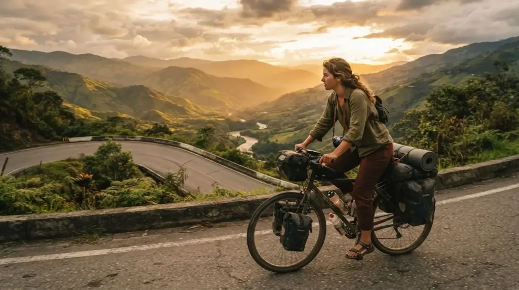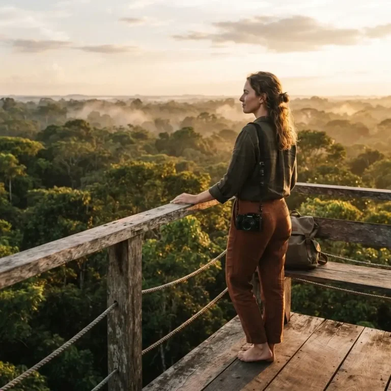
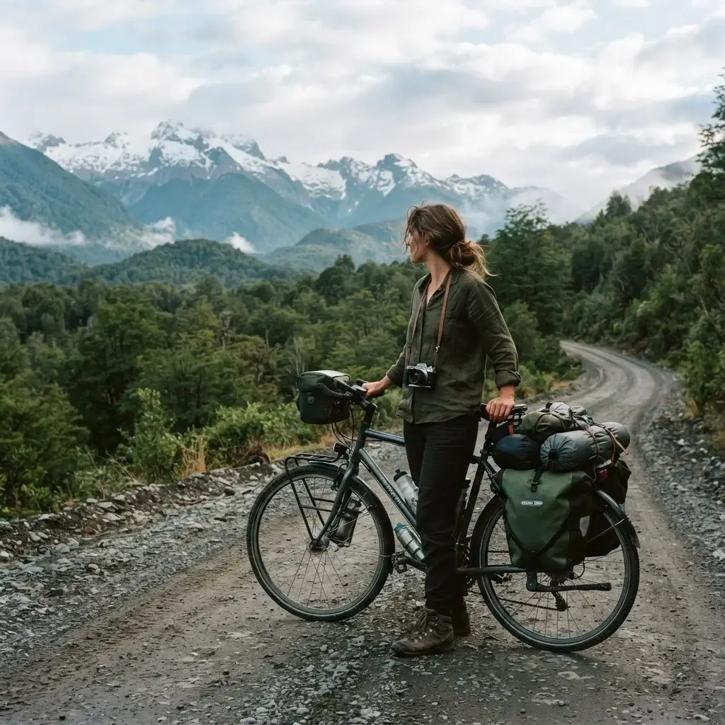
There is something that happens when you’re moving through a landscape at 10 miles per hour instead of 60. You actually see it. You smell the pine forests. You hear the river before you reach it. A truck driver waves at you from the highway. A kid on the roadside stares at your loaded panniers like you’re from another planet. That particular version of travel, slow and sensory and completely exposed to the world around you, is what cycling gives you.
I’ve spent a lot of time thinking about what makes travel feel real and what makes it feel hollow. When I backpacked solo across Europe, the moments that stuck were never the famous museums or the perfectly timed tour group photos. They were the side streets, the wrong trains, the conversations with strangers. Cycling is that feeling, multiplied. Your whole body is involved. You earn every single mile. And in the Americas, you have some of the most staggering roads on the planet to do it on.
This guide is for you if you’re seriously considering a bicycle road trip and need help figuring out which route matches where you are right now, physically and logistically. I’m not going to pretend every road on this list is beginner-friendly, because it isn’t. But I am going to be honest about what each one requires, and I think you’ll find at least one that makes you think, “okay, I could actually do that.”
What You Actually Need Before You Go
Before we get into routes, let’s get one thing out of the way: you don’t need to be a serious cyclist to do a bicycle road trip. You need to be someone who can work up to riding 40-70 miles a day with a loaded bike, which is a very learnable thing given the right preparation time. Most long-haul tourers recommend building to that over 8-12 weeks of regular riding before your trip.
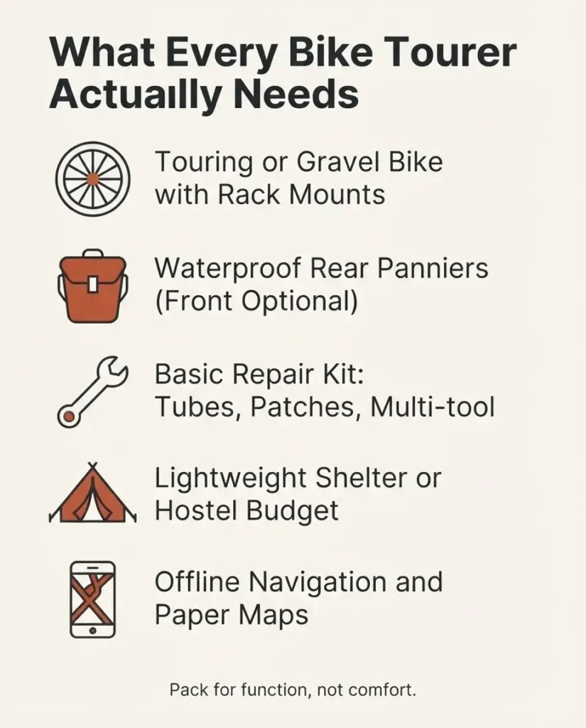
Gear-wise, you need a touring-specific or gravel bike with rack mounts for panniers (bags attached to the sides of your rear wheel), a basic repair kit, and a solid weather-resistant setup for camping or a mix of camping and hostels. If you want a straightforward starting point on what to actually pack, the Adventure Cycling Association’s gear starter guide is one of the most practical free resources out there. They’ve been mapping North American routes since 1973 and genuinely know what riders need.
The most common mistake beginners make is overloading. Pack for function, not comfort. You will thank yourself on the first big climb.
The TransAmerica Trail: Cross the Entire Country on Two Wheels
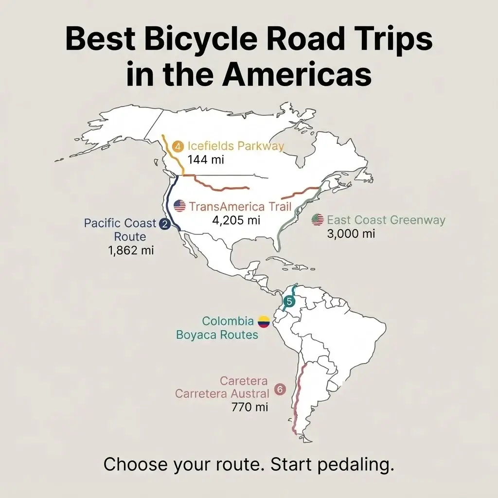
If there is one bicycle route that defines American cycling history, it’s the TransAmerica Trail. Stretching 4,204.9 miles from Astoria, Oregon, on the Pacific coast to Yorktown, Virginia, on the Chesapeake Bay, this route has been ridden by adventurers since 1976, when 4,000 cyclists completed it in a national celebration of America’s bicentennial. The stories from that first crossing, most of those riders in their twenties with no long-distance experience and no helmets, are honestly a comfort when you’re second-guessing yourself.
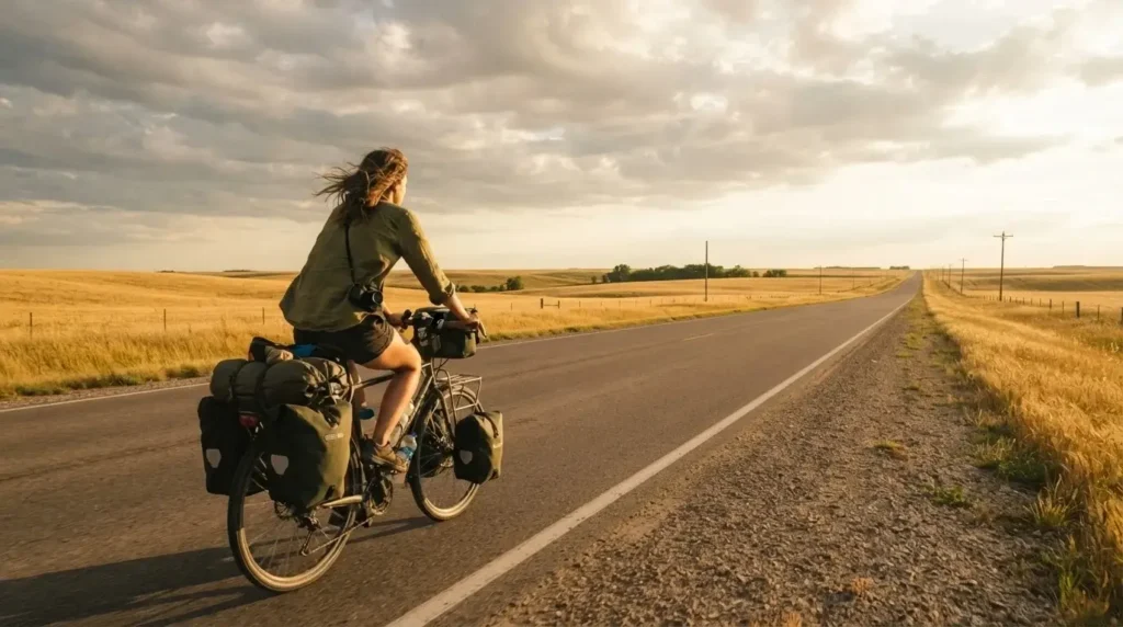
The route takes you through Yellowstone and Grand Teton National Parks in Wyoming, over the Continental Divide at Hoosier Pass in Colorado at 11,542 feet (the highest point on the entire route), across the flat and famously hospitable plains of Kansas, through the Ozarks of Missouri, and finally through the rolling Appalachians and into the Revolutionary War-era coast of Virginia. Each region feels like a completely different country. The western section is remote, dramatic, and physically demanding. The Kansas stretch is flat, hot, and strangely meditative. The eastern section is green, hilly, and rich with history.
Plan for roughly three months if you want time to actually experience the places you’re riding through. The best riding season is May through September, though high-altitude sections in Colorado can have snow at any point, so watch the weather carefully. Camping options range from free city parks in Kansas to national forest land in the west. You can find every detail of the route, including alternate options and regular updates, at the official Adventure Cycling TransAmerica Trail page.
What solo riders consistently report about this route is that the sense of community is unlike anything else. Journals kept in cafes and churches along the way, written by cyclists from previous years, give you a feeling of traveling with thousands of people who went before you. That shared thread of the road is its own kind of culture.
For food along the way, don’t skip the local diners through Missouri and Kentucky. The pies, the biscuits, the plates of barbecue that appear in small-town roadside restaurants are a significant part of the experience. Cyclists often call Kansas “legendary for its hospitality,” and from what long-distance riders report, towns regularly open their parks and sometimes their homes to people passing through on the trail.
Best for: Riders who want a big, life-marking adventure and have 2-3 months. Requires solid fitness and self-sufficiency in remote sections.
The Pacific Coast Route: Big Sur, Redwoods, and the Long Way South
This is the route that gets under people’s skin most. Running 1,862.6 miles from Vancouver, British Columbia, all the way down to the Mexican border at Imperial Beach, California, the Pacific Coast Route follows one of the most scenic coastlines in the world. Sea lions barking on rocks off the Oregon coast. Massive old-growth redwoods casting shadows across the road in Northern California. The curve of Big Sur’s Highway 1, hanging above the Pacific so dramatically that it’s appeared in roughly half of all car commercials ever made.
The terrain starts relatively gentle in Washington and southern British Columbia, with flat-to-rolling coastal landscape, then gets progressively hillier as you move down the Oregon coast (those headland climbs are real, and they’re worth every painful pedal stroke for the views on the other side). Northern California is consistently hilly. Southern California flattens out but compensates with urban complexity and beach path riding.
Spring and autumn are the ideal seasons. Summer brings heavy recreational vehicle traffic on Highway 101, which makes riding less pleasant and occasionally stressful. The Oregon coast state parks have dedicated hiker-biker campsites that cost roughly $20-30 per night and are available on a first-come, first-served basis. In California, prices at beach campgrounds climb to $30-50 per night. You’ll want to carry extra food and water between Half Moon Bay and Davenport south of San Francisco, where services thin out significantly.
Crossing the Golden Gate Bridge into San Francisco is one of those moments cyclists describe in detail for years afterward. On weekends, use the west sidewalk. On weekdays, the east sidewalk opens early. Plan this moment carefully because you want to be present for it, not stressed about traffic.
For solo riders, this is one of the most accessible long routes in the Americas because services are relatively frequent compared to inland routes, the overall safety is high, and there is a well-established community of cyclists who have ridden it before you.
What to eat: the Dungeness crab along the Oregon and Northern California coast is a matter of real importance. Sit down for it. Don’t eat it out of a paper bag while riding.
Best for: Riders who want coastal scenery, manageable services, and a classic American road cycling experience.
The East Coast Greenway: A Different Kind of American Journey
Most cyclists think about heading west for a big bike trip. The East Coast Greenway makes a compelling argument for heading north or south instead. Stretching 3,000 miles from Key West, Florida, all the way to Calais, Maine, on the Canadian border, this route connects 15 states and 450 communities through a combination of dedicated trails, bike paths, and quieter road sections.
It’s worth being honest: the Greenway is still being developed, meaning some sections use roads rather than fully separated trails. But that’s also part of its character, you move through actual cities and towns, urban neighborhoods, seaside communities, and the full social fabric of the East Coast. You cycle through Washington D.C., Philadelphia, New York City (yes, through the city I know well from years of guiding people around it), Boston, and Portland, Maine. You also find yourself on quiet salt marsh trails in South Carolina and beneath old live oak canopies in Georgia.
For solo travelers, especially those new to long-distance riding, the Greenway’s density of services makes it genuinely beginner-accessible. You are rarely far from a town, a meal, or a place to sleep. The official route map at greenway.org lets you drill into specific sections by state, which is useful if you want to ride a portion rather than committing to the full distance right away. Riding section by section over multiple trips is a completely valid approach.
The cultural range of this route is something that doesn’t get talked about enough. Cycling from the Florida Keys through the deep South, through Mid-Atlantic cities, through New England coastal towns, and into maritime Maine is essentially a sociology of the American experience. Every 100 miles, the food, the architecture, the accents, and the pace of life shift.
For food: in the Carolinas, stop for proper pulled pork. In Maryland, the crab cake question is not optional. In Maine, the lobster rolls need no explanation.
Best for: Riders who want cultural richness, manageable logistics, and the option to ride in sections. Also strong for riders who specifically want the solo-in-a-city experience.
The Icefields Parkway, Canada: The Most Beautiful Road in the World
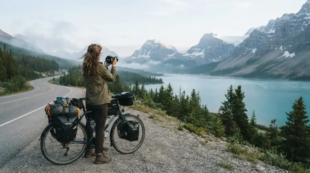
People use that phrase “most beautiful road in the world” carelessly. For the Icefields Parkway in Alberta, Canada, the description actually holds up. Running 232 kilometers (144 miles) between Lake Louise and Jasper through the heart of the Canadian Rockies, this route delivers turquoise glacial lakes, active icefields, mountain peaks, and a consistent sense of visual overload that takes days to process.
It is also a physically demanding ride. The Rockies don’t flatten for anyone, and cyclists face significant climbing throughout the route. The scenery compensates in full, but you want to be honest with yourself about your fitness level before committing to this one. Parks Canada’s official Jasper cycling page recommends riding before 10am and after 5pm to minimize vehicle traffic, which is solid practical advice given that this is also one of Canada’s most popular driving routes.
The best season is June through September. Campgrounds are plentiful and many are positioned with views that would cost hundreds of dollars a night in a hotel. Wildlife encounters are common: elk, bighorn sheep, bears, and wolves all share this landscape. Standard bear safety protocols apply, including hanging food properly when camping.
What long-distance cyclists consistently describe about this route is the sense of earned solitude. Because you are moving slowly through a landscape that most people drive through in a few hours, you see it completely differently. You stop at the Athabasca Glacier and feel the cold air coming off it. You sit beside Peyto Lake at a moment when the tourist buses haven’t arrived yet. That is the reward for being on a bike.
For food: Jasper town is small but has excellent spots for a full recovery meal after a big riding day. Banff, at the southern end, has more options including good cafes for the kind of breakfast you genuinely need before a mountain pass.
Best for: Riders with solid fitness who want high mountain scenery and a shorter, contained route they can complete in 5-7 days.
The Carretera Austral, Chile: Raw Patagonia on Two Wheels
This is the one that tends to appear in the dreams of more experienced riders. Chile’s Carretera Austral, or Ruta 7, runs approximately 1,240 kilometers (770 miles) through Patagonia, from Puerto Montt in the north down to the remote outpost of Villa O’Higgins in the south. It passes through temperate rainforest, across rivers spanned by one-lane bridges, beside fjords so still they look painted, and through stretches of such complete isolation that the silence itself becomes a thing you notice.
It is not a beginner route. A significant portion is unpaved gravel (locally called “ripio”), which demands wider tires, more technical skill, and a much higher tolerance for mud, rain, and rough surfaces. The route is also interrupted by ferry crossings that are non-negotiable parts of the logistics. These ferries should be booked at least a week in advance during the peak October-March season. Wind in Patagonia is serious and unpredictable, capable of stopping a cyclist completely on exposed sections. None of this is said to discourage you. It’s said because the people who fall deepest in love with this road are the ones who went in knowing exactly what they signed up for.
The Bicycle Patagonia complete guide to the Carretera Austral is one of the most detailed route-specific resources available and worth reading carefully before you plan. The total route covers around 960 km of mapped road and the planning required for the remote southern sections, where services are infrequent and ferries run less often, is genuinely different from what you’d manage on a North American touring route.
For food on the Carretera Austral, the curanto, a traditional slow-cooked stew of meat, shellfish, and potatoes, is something solo riders who have done this route consistently mention. In the small settlements along the route, family-run places called hosterias often serve whatever was caught or grown that week. This is not food you plan, it’s food you find, and that is one of the best things about slow cycling travel.
Best for: Experienced tourers comfortable with gravel, self-sufficiency, and remote travel. Not recommended as a first long-distance cycling trip.
Colombia’s Boyaca Region: The Cycling Nation You Haven’t Planned Yet
Colombia doesn’t appear on most “best cycling Americas” lists, and that is a mistake. The country has produced some of the greatest professional climbers in the history of cycling, and the reason is simple: the roads through the Andes are brutal, beautiful, and seemingly endless in their elevation. The Boyaca region, a few hours north of Bogota, sits at the heart of the country’s cycling culture and offers some of the most dramatic riding in South America.
The routes around Villa de Leyva, Tunja, and the surrounding mountain roads give you multi-day routes ranging from 80 to 200 kilometers through colonial towns, high altitude moorlands called paramos, and landscapes that feel nothing like anywhere else on the continent. Colombia’s official tourism board has a useful overview of the country’s best cycling routes at colombia.travel, which helps you understand the geographic variety before you commit to a specific region.
Bogota’s famous Ciclovia, every Sunday morning, closes major city roads to cars and opens them entirely to cyclists, pedestrians, and skaters. It’s one of the great urban experiences in the Americas and a good way to orient yourself in the city before heading into the mountains.
From what solo riders consistently report, Colombia’s hospitality toward cyclists is remarkable. The country has genuine cycling culture at every level of society, from the Sunday riders in Bogota to the professional teams training on mountain roads. People recognize what you’re doing and respect it. Safety in tourist-frequented cycling areas has improved dramatically over the past decade, though as with any destination, staying informed about current local conditions and sticking to well-traveled routes is always the right call.
For food: the bandeja paisa, a mountain-sized platter of beans, rice, chorizo, chicharron, avocado, and a fried egg, is the refueling meal you need after a climbing day in the Andes. Order it, eat all of it, and thank yourself on the next ascent.
Best for: Riders who want cultural depth, epic climbing, and a destination that feels genuinely off the beaten path for cycle tourists.
Practical Notes That Actually Matter
A few things that apply across all of these routes, regardless of which one you choose.
Getting your bike there matters more than most guides admit. Most major airlines carry bicycles as checked baggage, typically in a hard or soft case, for fees that range from $30 to $150 depending on the airline and route. Check specific airline policies before you book. Amtrak in the US allows bikes on many routes either boxed or, on certain trains, fully assembled. Check the Adventure Cycling Association’s Amtrak guide for current specifics.
Connecting with other cyclists on the road is one of the real gifts of this style of travel. The Warmshowers community (a free hospitality network for bicycle tourers) gives riders the ability to stay with host cyclists in towns along their route. It’s genuinely one of the best ways to experience local life rather than just riding through it.
Insurance matters. Standard travel insurance often excludes cycling accidents, so read your policy carefully before you go, and specifically look for coverage that includes emergency evacuation, which becomes relevant on remote routes like the Carretera Austral.
Which Route Is Actually Right for You
Here is the honest version of that answer. If you’ve never done a multi-day cycling trip, start with the East Coast Greenway or a section of the Pacific Coast Route. Both give you frequent services, established cycling communities, and the option to abbreviate if life happens. Once you have a multi-week trip under your legs, the TransAmerica Trail or the Icefields Parkway open up. If you’re a seasoned tourer who has done several long-distance routes and wants a genuine challenge with a deep cultural experience, Colombia’s Boyaca region or the Carretera Austral are the ones that riders talk about for the rest of their lives.
The honest truth about this kind of travel, from everything I’ve seen and read and heard from cyclists who have done these routes, is that the route matters less than the decision to go. The road teaches you things about your own capacity that no amount of planning research can replicate. You figure out what you need, you learn to ask for help, you solve problems you didn’t know you’d face, and somewhere along the way the daily rhythm of riding, eating, sleeping, and starting again becomes not a challenge but a life. That’s the version of travel I’m always trying to describe, and I think you already know it’s what you’re looking for.
Pick a route. Start training. Book a flight. The road will do the rest.