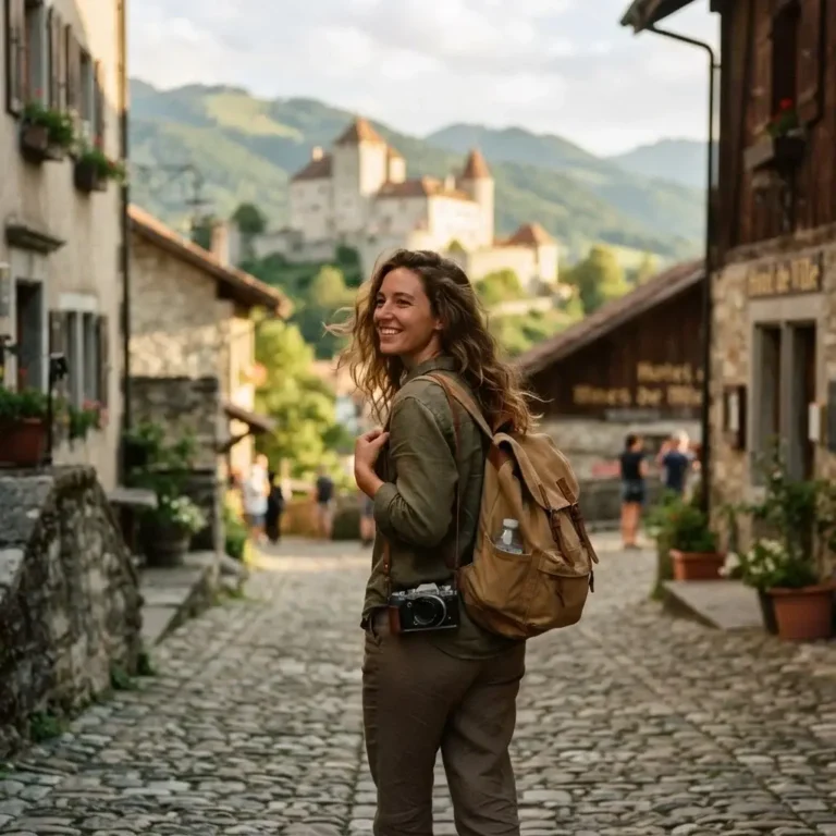
I still remember the exact moment I decided to change my life. I was standing on a busy street corner in Manhattan, working my job as a certified New York sightseeing guide. I was pointing at massive concrete skyscrapers, shouting over the noise of taxi horns, and smiling for tourists. It was a good job. It paid the bills. But deep down, I felt completely hollow. I spent my days talking about other people’s adventures instead of living my own.
For years, I had followed the standard path. I went to college. I got an office job after my time as a guide. I sat at a desk and stared at a screen, waiting for those precious two weeks of vacation every year. I waitressed on nights and weekends just to save up enough money to escape. I realized that cramming my entire life into 14 days of freedom a year was not going to work for me.
So, I quit. I packed my bags, stepped far outside my comfort zone, and started exploring the world on my own terms.
When you travel solo, you learn to trust yourself. You learn that you are capable of so much more than society tells you. And there is no better place on earth to test that new confidence than in the wild, dramatic mountains of Scandinavia.
Finding the best hiking trails in Norway is a dream for many people. But looking at photos online is very different from actually standing at the bottom of a massive, cloudy mountain by yourself, wondering if you brought the right boots. If you are sitting at home right now, daydreaming about deep blue water and sheer rock cliffs, I am writing this for you. I want to help you push past the fear, plan your trip, and get out there.
Here is my complete, unfiltered guide to the fjords. No luxury fluff. Just real, practical advice for normal people who want to experience something truly amazing.
Getting Ready: Safety, Weather, and Solo Travel Realities
Before we talk about pretty views, we need to talk about reality. Norway is wild. The weather does whatever it wants, whenever it wants. You can start a hike in bright sunshine, get caught in a freezing rainstorm halfway up, and finish the hike in thick fog.
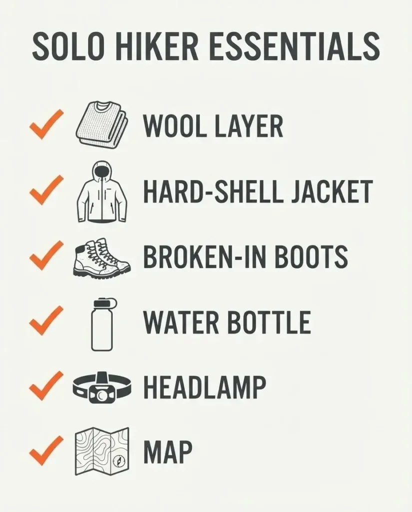
When you are hiking alone, you do not have a partner to rely on if things go wrong. You have to be your own backup plan. This means you must pack smart. Never wear cotton on the trail. Cotton traps your sweat, gets cold, and stays wet. You need merino wool base layers. Wool keeps you warm even when it is soaking wet. You also need a hard-shell waterproof jacket, waterproof pants, and stiff, broken-in hiking boots with deep tread.
Because mountain weather turns on a dime, I always read through the practical traveler safety content pages from World Nomads to make sure my insurance covers alpine rescues just in case. You do not want to be stuck paying for a helicopter ride out of pocket because you twisted your ankle on a wet rock.
Planning ahead also means taking care of the boring paperwork before you leave home. If you are flying in from the United States or anywhere else outside of Europe, it pays to double-check the entry requirements and safety ratings at the US Department of State Travel site so you don’t get stopped at the border. Having all your documents in order is the first step to feeling confident on your trip.
The Best Hiking Trails in Norway: My Top Fjord Picks
I have put together a list of the exact trails you need to know about. I will tell you how to get there, what to eat, and the little secrets that most guides leave out.
Preikestolen (Pulpit Rock) – The Confident Starter
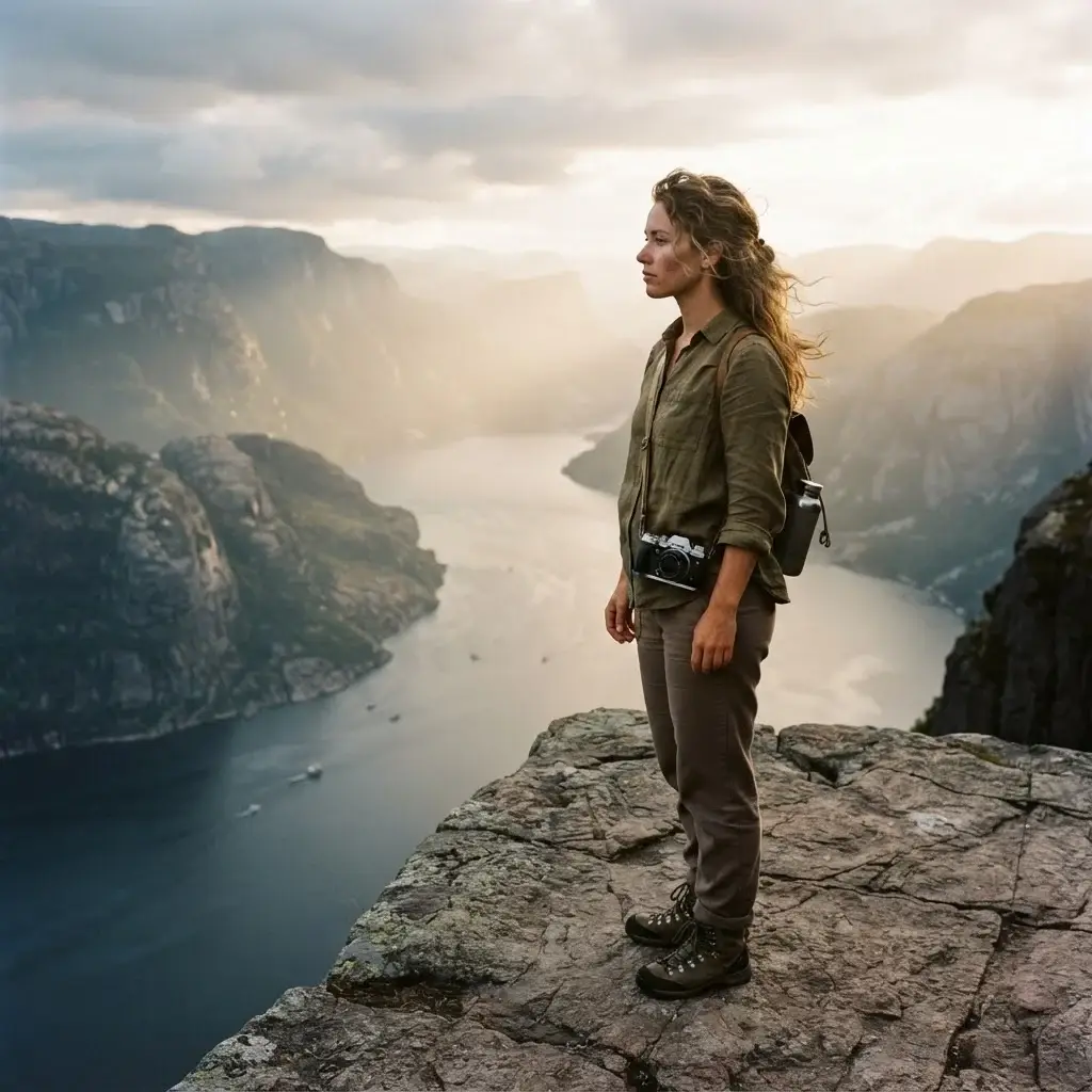
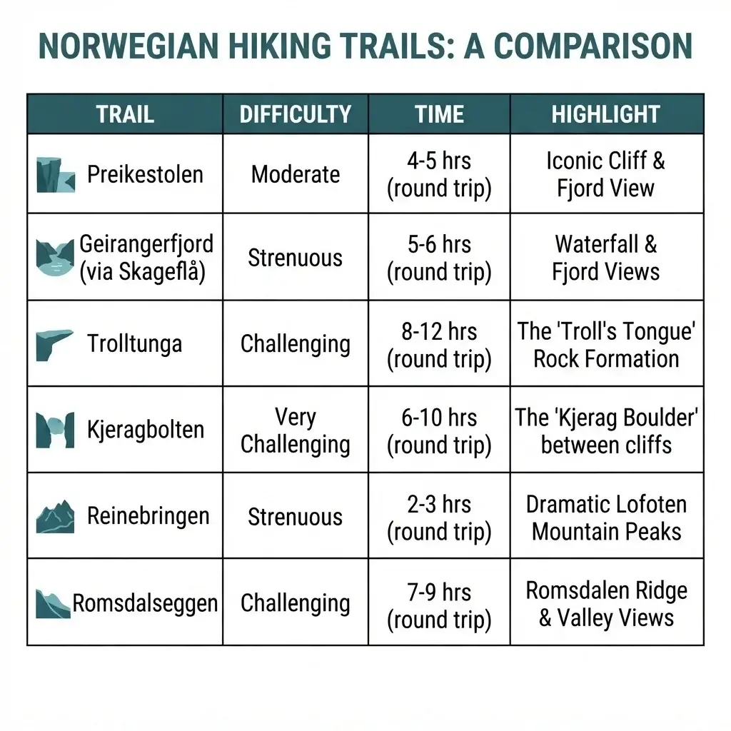
If you have never hiked a mountain alone before, start here. Preikestolen is famous for a good reason. It is a massive, flat block of rock that sticks straight out over the Lysefjord, dropping over 1,900 feet straight down into the water. It looks scary in photos, but the hike itself is actually very manageable.
Navigation Advice: You do not need a rental car for this. Base yourself in the city of Stavanger. From the city center, you simply walk to the ferry terminal, take the fast passenger ferry to the town of Tau, and then hop on the matching shuttle bus that waits right at the dock. The bus drives you directly to the trailhead parking lot (Preikestolen Fjellstue). The trail is wide, heavily marked with painted red ‘T’ symbols, and features large stone steps carved by Nepalese Sherpas. It takes about two hours to get up and two hours to get down.
Insider Secrets: Because this hike is famous, it gets incredibly crowded. If you go at noon in July, you will be walking in a straight line with hundreds of other people. My secret? Go early or go late. Catch the very first ferry of the morning in the dark. Bring a headlamp. Walking through the quiet pine forest while the sun slowly comes up over the water is a memory I will never forget. You will have the rock almost entirely to yourself.
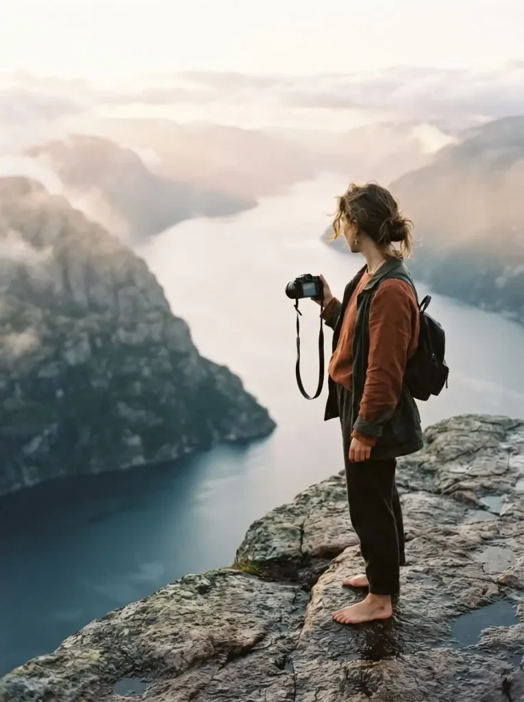
Culinary Tips: What to Eat: You cannot hike in Norway without adopting their snack habits. Go to a REMA 1000 grocery store in Stavanger and buy three things: a thermos, a bag of local coffee, and a Kvikk Lunsj. A Kvikk Lunsj is a Norwegian chocolate bar that looks exactly like a KitKat, but tastes ten times better. It is the unofficial national hiking snack. Sitting on the edge of Pulpit Rock with a hot cup of black coffee and a piece of chocolate is pure magic.
Geirangerfjord: Vesterås to Storsæterfossen
This hike gives you the classic, deep-cut fjord views without the brutal physical punishment of the longer trails. Geiranger is a tiny village tucked at the very end of a narrow, winding arm of the sea. Geirangerfjord is heavily protected for a reason, and you can read all about its deep blue waters and sheer cliffs over on its official site page for this UNESCO-listed destination before you pack your bags.
Navigation Advice: Getting to Geiranger is half the fun. You can take a bus from the town of Ålesund, or ride the famous car ferry from Hellesylt. Once you are in Geiranger village, you can actually walk up the steep road to Vesterås farm. This farm is the starting point for the trail. From the farm, follow the signs pointing to Storsæterfossen. The hike only takes about an hour each way. It is steep in parts, but there are stone steps and dirt paths the whole way up.
Insider Secrets: The secret here is the destination itself. Storsæterfossen is a massive waterfall, but you do not just look at it from the front. The trail actually goes behind the falling water. There is a small, wet rock ledge that lets you walk right into the cave behind the falls. It is loud, misty, and incredibly powerful.
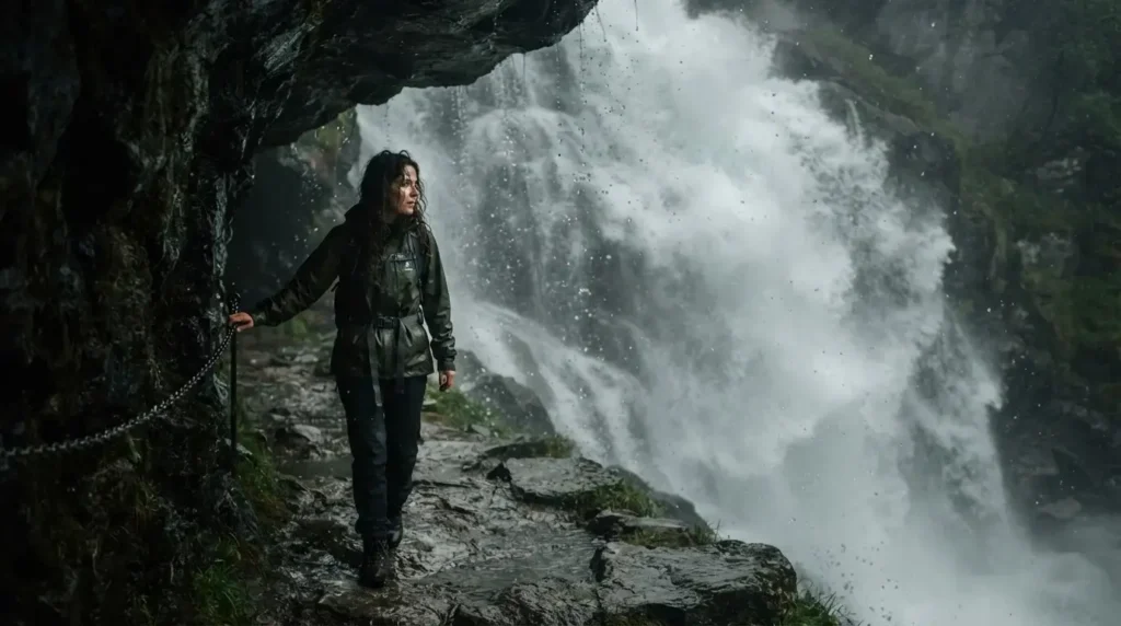
Make sure you put your rain jacket on before you step behind it, or you will get soaked by the spray.
Culinary Tips: What to Eat: When you are on the ferry heading to Geiranger, go straight to the small cafeteria counter on the boat and order a “Svele.” This is a traditional Norwegian pancake that is folded in half and filled with sweet butter and sugar, or sometimes a slice of brown cheese. It is thick, warm, and comforting. After the hike, go back to Vesterås farm. They have a tiny cafe there where you can sit outside, look down at the fjord, and eat fresh waffles with sour cream and jam.
Trolltunga (The Troll’s Tongue) – The Ultimate Test
This is the big one. This is the hike that tests your limits. Trolltunga is a long, thin piece of rock that juts out horizontally above Lake Ringedalsvatnet. The photos are incredible, but the physical effort required to get that photo is massive. This is a 17-mile round trip hike. It will take you between 10 and 12 hours. You must be in good physical shape to do this alone.
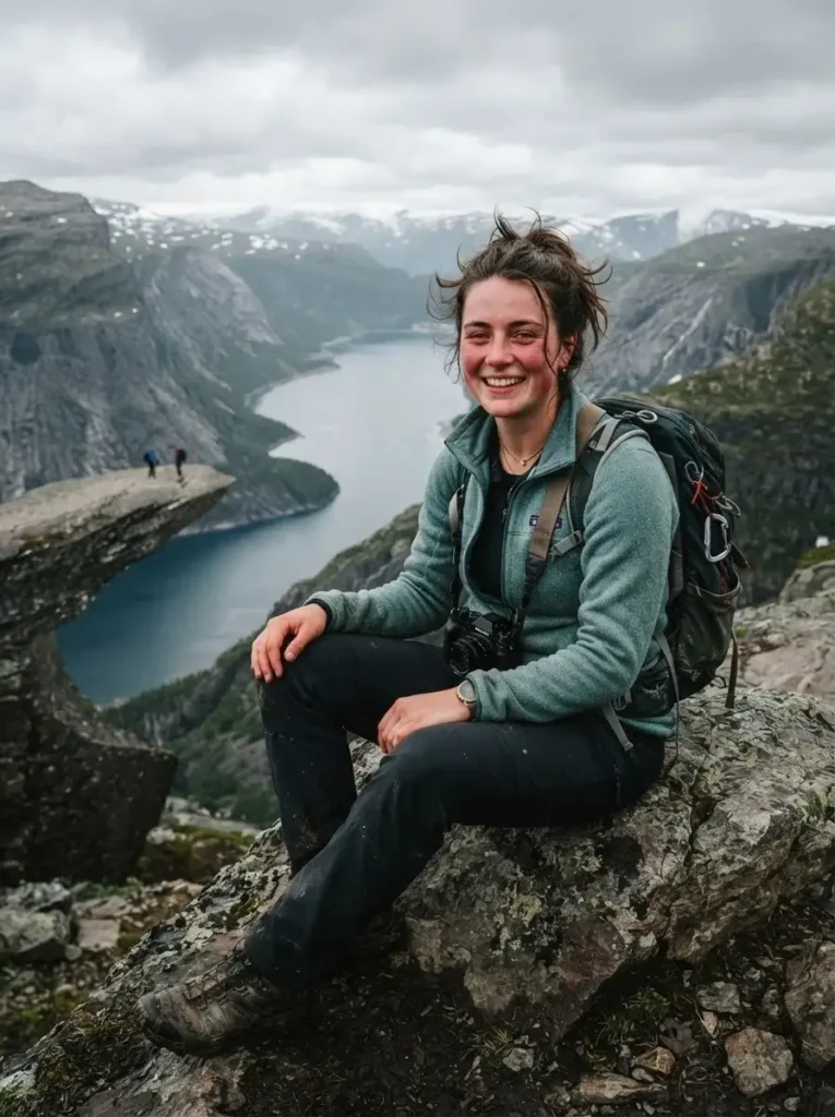
Navigation Advice: Your home base for this hike will be the industrial town of Odda. Since Odda is such a tiny town that gets overrun in summer, I highly recommend checking out the destination overview pages on Lonely Planet to wrap your head around alternative lodging options nearby. From Odda, you take a shuttle bus to the main parking lot at Skjeggedal.
Here is my best navigation advice: Do not start walking from Skjeggedal. There is an upper parking lot called P3 Mågelitopp. If you book a shuttle ticket in advance, a small bus will drive you up the first set of brutally steep, boring paved switchbacks. This saves you about 400 meters of elevation gain and an hour of miserable walking on a road. From P3, the real trail begins. It is rocky, muddy, and feels like it goes on forever.
Insider Secrets: The mental game on this trail is tough. You will experience false summits. You will walk up a huge hill, thinking the rock is right on the other side, only to see another huge hill waiting for you. Just put your head down and keep moving. Also, when you finally reach the tongue, there will be a line of people waiting to take their photo. It can take up to an hour of waiting in the cold wind just for your turn. Bring an extra warm puffy jacket just for standing in this line, because your sweat will freeze you once you stop moving.
Culinary Tips: What to Eat: For a 12-hour hike, you need serious fuel. This is the time to embrace the “Matpakke.” A matpakke is the traditional Norwegian packed lunch. You buy a loaf of heavy, dark, whole-grain bread. You cut thick slices. Then, you buy a block of “Brunost” (Norwegian brown cheese).
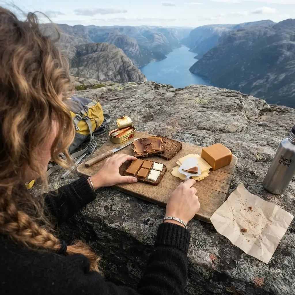
It is a sweet, caramelized cheese that tastes a bit like caramel and fudge. Slice the cheese, put it on the bread, and wrap it tightly in parchment paper. It does not need to be refrigerated, it gives you massive amounts of energy, and it tastes incredible when you are sitting on a cold rock halfway to the sky.
Kjeragbolten – The Boulder of Courage
If heights make your stomach drop, this trail will push you right to your edge. Kjeragbolten is a giant, round boulder that is wedged tightly between two sheer rock walls, suspended nearly 3,200 feet above the Lysefjord. People hike up there specifically to step out onto the boulder.
Navigation Advice: You access this hike from the tiny village of Lysebotn, located at the very end of the Lysefjord. Getting there usually involves taking a tourist ferry from Stavanger down the length of the fjord, then hopping on a bus that drives up 27 dizzying hairpin turns to the Øygardstøl parking lot.
The hike is about 6 miles round trip and takes around 5 to 6 hours. But do not let the short distance fool you. The first section is incredibly steep and features bare, smooth granite. The trail maintainers have bolted thick metal chains into the rock for you to hold onto while you pull yourself up the slick stone.
Insider Secrets: Do not even attempt this hike if it is raining. The smooth granite rock faces turn into an ice rink when wet, and it becomes genuinely dangerous. Once you get to the boulder, there is a small, narrow ledge hidden around the backside that you use to step onto the rock. Do not look down. Look straight across at the opposite wall, step out, get your photo, and step back. The wind up there is strong, so stay low to the ground.
Culinary Tips: What to Eat: This hike burns a lot of nervous energy. When you finally finish and make it back down to the valley floor in Lysebotn, head to the small pub near the campground and order a massive bowl of Fiskesuppe. This is a rich, creamy Norwegian fish soup loaded with chunks of salmon, cod, root vegetables, and fresh dill. It comes with thick bread and salty butter. It will warm you up from the inside out and replace all the calories you just burned sweating over that boulder.
Reinebringen – The Stairway to Heaven in Lofoten
Let’s move away from the southern fjords and head far north, above the Arctic Circle, to the Lofoten Islands. The mountains here look completely different. They are sharp, jagged, and shoot straight up out of the freezing ocean like dragon teeth. Reinebringen offers the single most famous view in all of Lofoten. You look straight down over the tiny red fishing cabins of Reine village, surrounded by dark water and towering peaks.
Navigation Advice: You can fly into Leknes or take the public ferry from Bodø to Moskenes. From Moskenes, you take a local bus to the village of Reine. The trailhead starts right off the main E10 highway, just past the tunnel outside of town.
The trail used to be a deadly, muddy mess, but recently, a team of Sherpas built almost 2,000 stone steps all the way up the side of the mountain. It is basically a giant, brutal staircase. It takes about an hour and a half of pure stair-climbing to reach the top. Your calves will burn, your lungs will burn, and you will want to quit. Do not quit.
Insider Secrets: Even with the stairs, this mountain is steep. There are signs warning you about rockfalls, and they are completely serious. If you see someone hiking above you, be aware that they might accidentally kick a loose rock down on your head. Also, there is a false ridge near the top. You will hit a flat spot and think you are done, but you need to follow the dirt path to the left for another five minutes to get the actual view looking down into the village.
Culinary Tips: What to Eat: Lofoten is famous for one thing above all else: Cod. Specifically, dried cod called Stockfish (Tørrfisk). You will see massive wooden racks all over the islands with thousands of fish hanging by their tails, drying in the salty ocean wind. You can buy small bags of dried stockfish snacks at any local gas station. It is tough, chewy, incredibly salty, and very high in protein. It takes some getting used to, but it is the perfect lightweight trail snack. Pair it with an apple to balance the salt.
Romsdalseggen Ridge – The Scenic Giant
This is my personal favorite hike in all of Norway. It does not have a famous boulder or a troll tongue, but it offers the most expansive, jaw-dropping panoramic views I have ever seen. You walk along a narrow, knife-edge mountain ridge for miles, with the emerald green Rauma river snaking through the deep valley on one side, and the jagged peaks of the Troll Wall on the other.
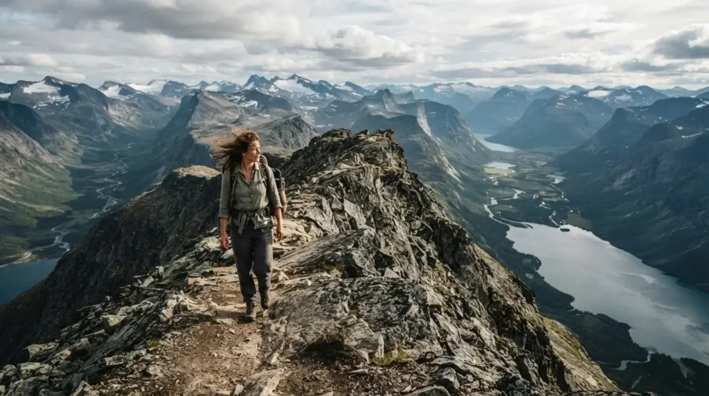
Navigation Advice: You start by taking a train or bus to the town of Åndalsnes, which is known as the mountaineering capital of Norway. This is a point-to-point hike, meaning you do not finish where you started. You must go to the main bus station in Åndalsnes and buy a ticket for the dedicated “Romsdalseggen bus.” This bus drives you about 20 minutes out of town and drops you off in a remote valley called Venjesdalen.
From the drop-off point, you hike up the mountain, walk across the massive ridge, and eventually hike all the way back down right into the center of Åndalsnes. The entire trek is about 6.5 miles and takes around 7 to 8 hours.
Insider Secrets: This is an exposed ridge walk. If you are terrified of heights, this will be very hard for you. There is one specific section called the Halsaskaret where the ridge gets very narrow, and you have to scramble over rocks with massive drops on both sides. Take it slow, use your hands, and trust your boots. Also, bring a lot of water. Once you are on the ridge, there are no streams to refill your bottles. If you are camping or drinking from streams along the ridge, it never hurts to review the destination health advisories on the CDC Travelers’ Health site regarding safe water practices abroad, though Norwegian mountain water is generally pristine.
Culinary Tips: What to Eat: Before you even get on the morning bus, stop at a local bakery in Åndalsnes and buy two fresh “Kanelboller” (Norwegian cinnamon buns). They are soft, sticky, and flavored with bright cardamom. Eat one on the bus to settle your nerves, and save the second one for the absolute highest point on the ridge. When you finally finish the hike and your knees are shaking from the steep descent, go straight to the local pub, Sødahlhuset, and order a cold local craft beer and a massive plate of hearty meatballs.
Trusting the Norwegian Trail System
When I first started hiking solo in Europe, I was terrified of getting lost. I used to pack three different paper maps and constantly check my phone GPS. But Norway has one of the best trail systems in the entire world, managed by the DNT (The Norwegian Trekking Association).
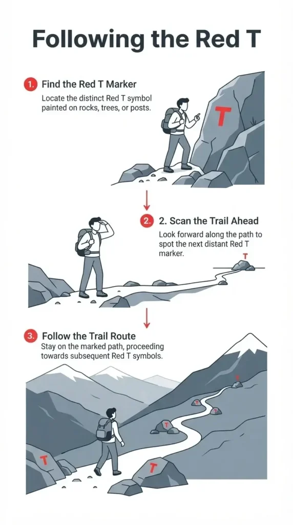
Every major trail is marked with a painted red letter ‘T’. You will see this bright red ‘T’ painted on rocks, trees, and stone cairns. The system is designed so that as soon as you stand at one ‘T’, you can look ahead and see the next one in the distance. It is like connecting the dots all the way up the mountain.
They also maintain hundreds of mountain cabins across the country. Some are staffed and serve hot food, while others are self-service cabins where you pay on an honor system, chop your own wood, and cook your own food.
Knowing these cabins exist out in the wild gives you a massive sense of comfort. If a storm rolls in unexpectedly, you know there is a safe, dry place out there if things get really bad.
To navigate, I highly recommend downloading the local Norwegian trail app called Ut.no. It is entirely in Norwegian, but the maps are incredibly easy to read. It tracks your location via GPS even without a cell signal, and it shows you every single trail, cabin, and elevation profile you could ever need.
Why You Should Not Wait for the Perfect Moment
I talk to so many people who say they want to hike in Norway “someday.” They are waiting for the perfect moment. They are waiting for their friends to have enough money. They are waiting for their schedule to clear up. They are waiting for a time when they feel totally brave and prepared.
Let me tell you a secret: that perfect moment does not exist.
If I had waited for the perfect time to leave my job, or for a friend to join me, I would still be standing on that street corner in New York, pointing at buildings, living a life that did not fit me.
Solo travel is never perfect. You will probably get lost at least once. You will definitely get rained on. Your boots will get muddy, your legs will ache, and you might cry out of sheer frustration when you hit a false summit. But when you finally push past all of that, and you stand on the edge of a massive stone cliff looking down at a deep blue fjord that cuts through the earth like a knife, you will feel something incredible.
You will feel capable. You will realize that you navigated a foreign country, handled the wild weather, and climbed a mountain entirely on your own strength. That feeling is worth every drop of rain, every confusing bus schedule, and every single cent you spent to get there.
Stop waiting. Book the ticket. Buy the wool socks. Pack your bag. The mountains are waiting for you, and I promise you are strong enough to climb them.