Public Transportation in the Americas: A Solo Traveler’s Guide

One of the first questions I ask myself when planning any new trip is simple: can I get around without relying on taxis and ride-shares the whole time? Not because those options are bad, but because hopping on a local metro or bus tells you something about a city that no Uber ride ever will. You see the commuters. You hear the language in its natural rhythm. You figure out the rhythm of the place. And honestly, it saves you a lot of money.
The Americas cover an enormous range of transit realities, from world-class metros that move millions of people flawlessly every day to chaotic bus systems that only make sense if you’ve lived there for years. If you’re planning a solo trip to any major city on this side of the world, understanding what the public transport situation looks like before you land is one of the most practical things you can do.
This guide covers the cities with the strongest transit systems across North and South America, how to actually use them, what they cost, and what to genuinely expect as a solo traveler. I’m not going to dress it up or make it sound simpler than it is. Some of these systems are genuinely thrilling to use. Others require a bit of patience and street sense. All of them are worth knowing about.
North America: Transit That Punches Hard
New York City: The Subway That Never Sleeps
I grew up in New York, so this one is personal. The NYC subway is the backbone of daily life in this city in a way that’s hard to explain until you’ve experienced it. It runs 24 hours a day, 365 days a year, which makes it unique among major transit systems in the world. According to AllTransit’s performance rankings, New York City scores a near-perfect 9.6 out of 10 for transit connectivity, access to jobs, and frequency of service, ranking it first in the country.
As someone who worked as a certified sightseeing guide in Manhattan, I spent years watching visitors either love or fear the subway.
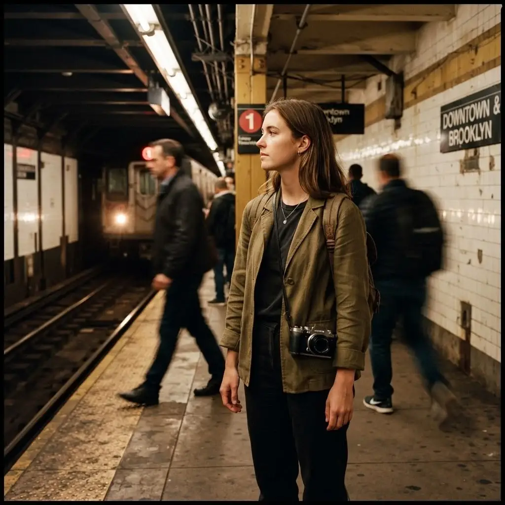
The ones who figured it out early always had a better trip. Here is what you actually need to know. Pay with a contactless credit or debit card directly at the turnstile, or load a MetroCard at any station kiosk. The flat fare is $2.90 per ride. The subway map looks complicated at first, but the basic principle is straightforward: local trains stop at every station, express trains skip stations and are faster for longer distances. Google Maps handles subway routing beautifully now, and you can check live train times in the MTA app.
For solo travelers, riding during off-peak hours is perfectly fine. During rush hour (roughly 7 to 9am and 5 to 7pm), trains get packed, and you need to watch your bag. Stand near the doors, keep your phone in your front pocket or bag, and you’ll be fine. The subway is loud, a little chaotic, and absolutely alive with the energy of the city. I genuinely love it, even when it frustrates me.
Chicago: The L Train and the Skyline
Chicago’s elevated train, universally known as “the L,” is one of the most visually dramatic transit experiences in the Americas. Parts of the system run outdoors on elevated tracks right through the heart of downtown, and if you’re on the Brown or Pink line curving through the Loop, the views of the city’s architecture are genuinely impressive.
The CTA’s visitor guide makes it easy to plan your trip before you arrive. The L fare is $2.50 per ride. For visitors, the Ventra card is your best option. The card itself costs $5, which is returned to you as transit credit when you register it. You can also buy 1-day, 3-day, or 7-day unlimited passes if you plan to move around a lot. Bus routes complement the L throughout the city, and together they cover virtually every neighborhood a solo traveler would want to reach.
The Red Line is the busiest and runs north to south through downtown, hitting neighborhoods like Wicker Park, Lincoln Park, and Wrigleyville. For safety on the L, the same common-sense rules apply: stay alert, keep belongings close on crowded trains, and if you’re riding late at night, position yourself in a busier car. Chicago solo travelers consistently describe the transit system as easy to navigate and surprisingly visitor-friendly once you stop second-guessing yourself.
Washington D.C.: Clean, Calm, and Easy to Love
The Washington Metro is arguably the most visually striking transit system in the United States. The stations are designed in a distinctive coffered concrete Brutalist style, with vaulted ceilings that feel more like cathedrals than underground rail stops. If you’ve only ever ridden the NYC subway, stepping into a D.C. Metro station feels like an upgrade.
The WMATA visitor guide explains everything clearly. Paying is simple: tap a contactless credit or debit card directly at the faregate, no card needed. You can also use a SmarTrip card or load a digital SmarTrip into your phone wallet. For visitors planning multiple trips, a 1-day unlimited pass costs $13.50 and a 3-day pass is $33.75. With 98+ rail stations, the Metro connects every major landmark and museum in the city, including the entire Smithsonian corridor on the National Mall.
For solo travelers, D.C.’s Metro is one of the easiest systems on this continent to use. The stations are well-lit, the signage is clear in English, trains run frequently during the day, and the system is generally calm and orderly. Unlike New York, the Metro does not run 24 hours, so plan your late nights accordingly. Trains typically stop running around midnight on weekdays and slightly later on weekends.
Mexico City: The Cheapest, Biggest, Most Iconic Metro on the Continent
Mention the Mexico City Metro to anyone who has ridden it, and they will almost certainly have a story. This system is extraordinary on multiple levels. With 12 lines, 195 stations, and over 226 kilometers of track, it is the most extensive metropolitan railway network in Latin America, carrying millions of passengers every single day.
The official Mexico City Metro guide describes it as a journey through the history, culture, and speed of the city, and that’s not marketing fluff. Each station has its own graphic icon, originally designed by Lance Wyman, that helps passengers identify stops even if they don’t read Spanish.
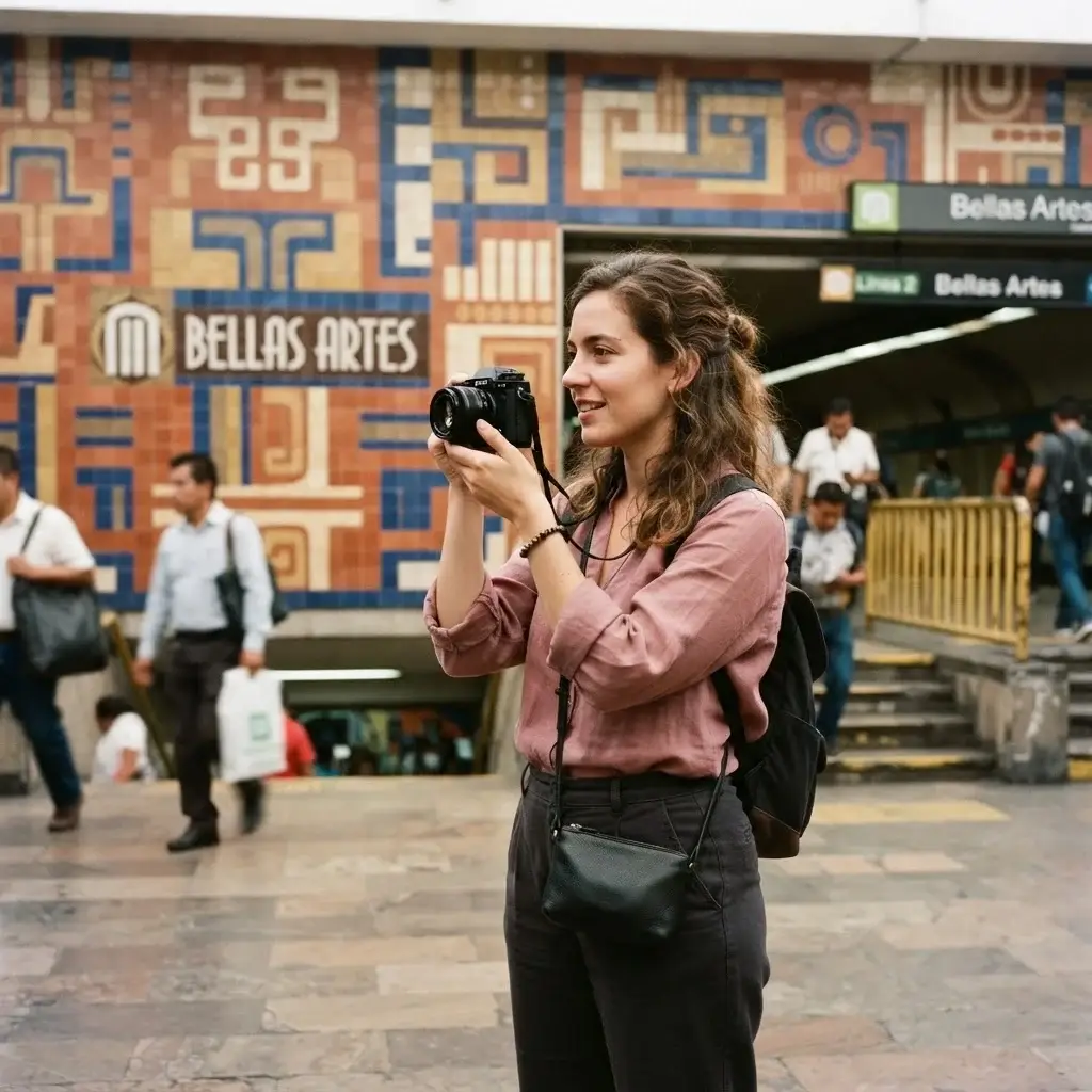
You see a grasshopper at Chapultepec. A snake at Insurgentes. A sun stone at Zócalo. It is genuinely clever and genuinely useful.
The fare is 5 MXN per ride, which currently works out to about 25 cents USD. That is not a typo. You can now pay with a contactless credit or debit card directly at the turnstiles, but it’s worth picking up the Integrated Mobility Card (called the MI card) at any station booth for 15 MXN. The system runs Monday through Friday from 5am to midnight, Saturdays from 6am to midnight, and Sundays and holidays from 7am to midnight.
A few practical notes for solo travelers, especially women. The first three cars on most trains are reserved exclusively for women and children under 12. These pink-marked cars are clearly signed on the platform and offer a noticeably more comfortable ride during peak hours. Rush hour runs from roughly 7:30 to 9:30am and 5:30 to 8pm, and trains become genuinely very crowded. Carry your bag in front of you. Keep your phone in your pocket, not in your hand. Those are the same habits that keep you safe in any busy metro in the world, and Mexico City is no different in that regard. Outside of peak hours, the system is manageable and easy to navigate.
Line 5 (Yellow) connects directly to Terminal 1 of Benito Juárez International Airport, which makes it easy to get into the city without a taxi from the moment you land.
What to Eat Near the Metro: The area around Zócalo station (Line 2, Blue) puts you in the heart of the historic center, where you can eat tacos al pastor at a street stall, sip atole from a market vendor, and wander through one of the most historically layered neighborhoods in the world. Mercado de San Juan, near Salto del Agua station, is one of the city’s great food markets.
South America: Where Transit Gets Creative
Santiago, Chile: The Standard-Setter for South America
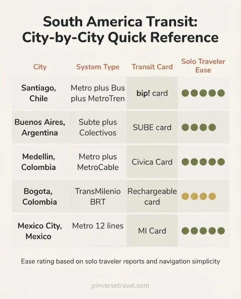
If you ask any transit expert which city in South America has the most reliable and modern metro, the answer is almost always Santiago. The Metro de Santiago is clean, air-conditioned, punctual, and integrated into a wider transport network that includes buses and commuter rail under a single payment system called Red Movilidad.
The bip! card is how you pay for everything in Santiago’s public transport network. You can buy it at any Metro station, at bip! service centers, and at authorized retailers including supermarkets. The integrated fare structure means you can transfer between metro, bus, and the MetroTren Nos commuter rail within a 120-minute window using a single payment. According to Red Movilidad’s official fare page, fares vary by time of day: 710 CLP during low hours (roughly 6 to 7am and 8:45 to 11pm), 790 CLP during off-peak hours, and 870 CLP during peak hours (7 to 9am and 6 to 8pm). That works out to less than $1 USD per ride at most times.
For solo travelers, Santiago’s metro is genuinely one of the easiest to use on this continent.
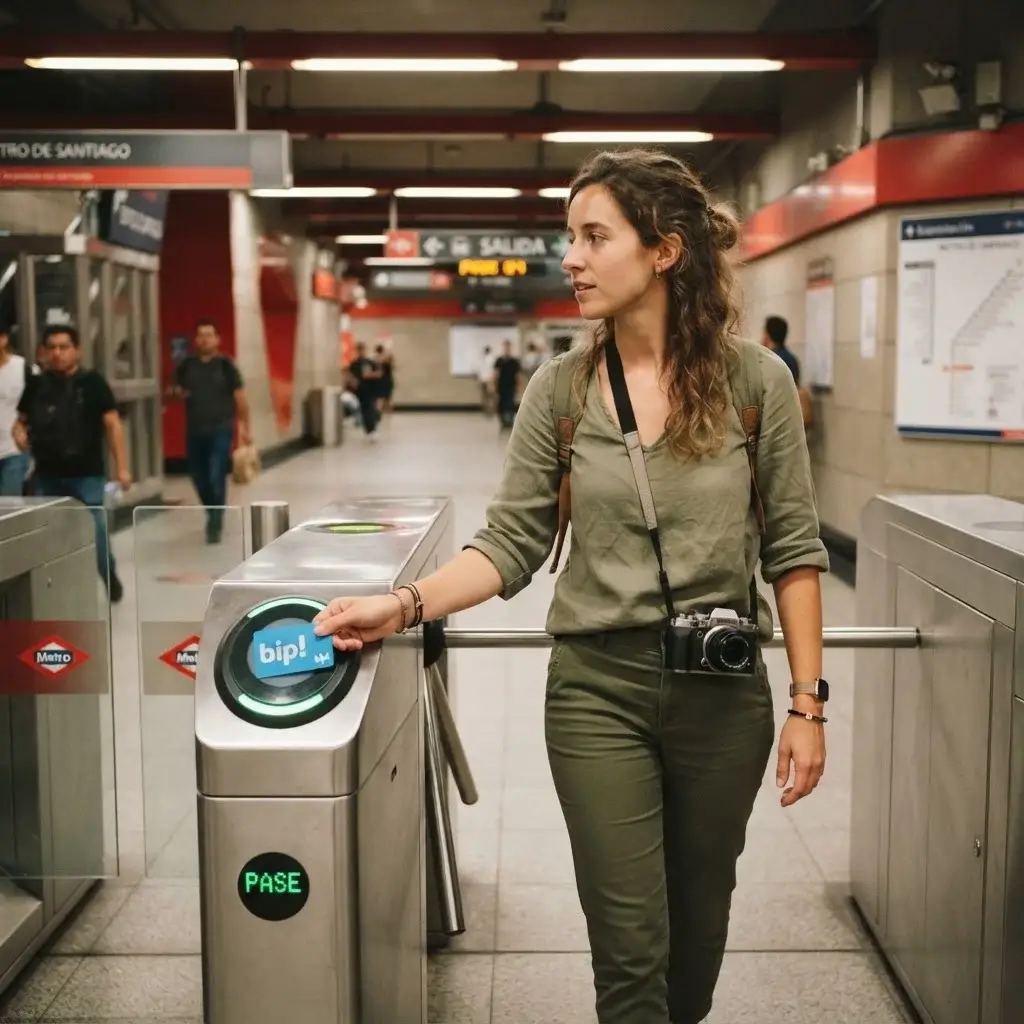
The system is well-signed, maps are clear, and the network covers the main neighborhoods you’ll want to explore: Barrio Italia, Lastarria, Providencia, Bellavista, and Las Condes are all reachable without a taxi. Stations have free WiFi. Trains are frequent, particularly on Lines 1 and 5, which carry the heaviest tourist traffic. Peak hours are crowded but not chaotic.
One thing solo travelers consistently note is how safe and orderly the Santiago Metro feels compared to systems in other South American cities. That reputation is earned. It’s still worth staying alert and keeping your bag secure, but the overall environment is calm and professional.
What to Eat Near the Metro: Get off at Baquedano station and walk into Barrio Bellavista for some of the best food Santiago offers. Empanadas, ceviche, and craft beer are all within a short walk of the station. For a proper Chilean lunch, look for a restaurant serving a set-price “menú del día,” which typically includes soup, a main course, and a drink for around 5,000 to 7,000 CLP.
Buenos Aires, Argentina: History, Colectivos, and the SUBE Card
Buenos Aires has the distinction of running the first underground metro system in Latin America. Line A of the Subte (as locals call it) opened in 1913, and riding it today still feels like stepping into a different era, particularly on the restored wooden cars that occasionally run on that original line.
The official Buenos Aires tourism site is one of the most thorough transit guides I’ve come across from a city government. It covers the Subte, buses (called colectivos or bondis), the SUBE card system, taxis, and cycling routes all in one place. For any visitor, this page is worth bookmarking before you land.
To use the Subte and colectivos, you need a SUBE card. Pick one up at any Subte station, at tourist assistance centers, or at corner kiosks (kioskos) around the city. The subway fare sits at approximately AR$757 per ride (around $0.50 USD at current rates, though Argentina’s exchange rate situation is worth checking before you travel, as it shifts). The Subte runs six lines covering the main arteries of the city, with trains running from about 5:30am to 11:30pm on weekdays. Colectivos run 24 hours a day across the full city, which makes them incredibly useful for late-night travel when the Subte is closed.
Buenos Aires is a large, walkable city with very distinct neighborhoods. Palermo, San Telmo, Recoleta, and La Boca are all reachable by transit. The colectivo system can feel overwhelming at first because there are hundreds of routes, but the app Moovit works well for Buenos Aires and will tell you exactly which bus to take and where to board.
For solo travelers, Buenos Aires transit is generally safe during the day and in well-trafficked areas. Evening travel on colectivos is common for locals, and with reasonable awareness, it’s manageable for visitors too. Watch your phone and wallet in crowded buses, particularly in the city center.
What to Eat Near the Metro: Get off at San Juan station on Line E and walk into San Telmo for one of the neighborhood’s traditional parrillas, where a proper Argentine asado (grilled meat feast) can be found at every price point. Sunday is especially good for the San Telmo market and street food vendors along Defensa Street.
Medellin, Colombia: The Cable Car That Changed a City
Medellin’s transit system is genuinely one of the most interesting stories in urban planning in the last 30 years. The city, once infamous for very different reasons, transformed itself in part through investing in public infrastructure, and the Metro system sits at the center of that transformation.
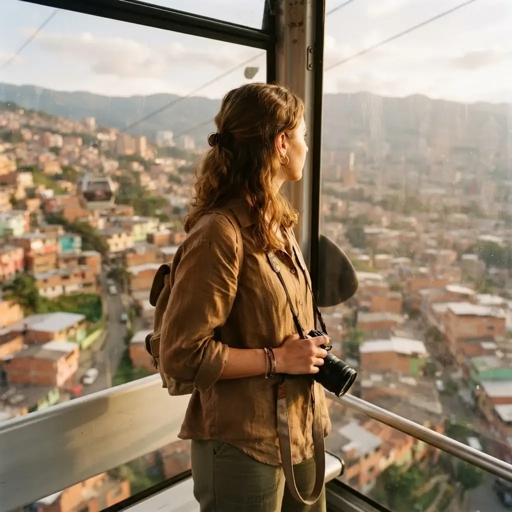
What makes Medellin’s system remarkable is not just the metro itself, but the MetroCable, a network of aerial gondola lines that climb from the metro stations up into the steep hillside neighborhoods (called comunas) that surround the valley. These were communities that had been cut off from the city for decades. The cable cars didn’t just solve a transport problem; they changed who had access to jobs, education, and the rest of the city. Riding the MetroCable to Parque Arví or Santo Domingo is one of the most memorable and genuinely meaningful transit experiences you can have anywhere in the Americas.
The official Metro de Medellin site has a tourist section with maps and route information in English. The integrated ticketing uses a Civica card, which you can load and manage through the App Cívica on your phone. The Metro runs two lines (A and B) connecting 27 stations, with MetroCable lines branching off from key stations. The system is clean, well-maintained, and considered one of the safest metro environments in South America.
For solo travelers, riding from the southern end of Line A up through the city to Acevedo station, then taking Line K of the MetroCable up to Santo Domingo, gives you one of the best aerial views of a South American city you will ever see. The ride is part of the experience, not just the means to an end.
What to Eat Near the Metro: Around Parque Berrío station in the city center, you’re in the heart of traditional Medellin street food territory. Bandeja paisa, the region’s signature dish of rice, beans, plantain, chorizo, chicharrón, and a fried egg, is available at sit-down restaurants nearby. Arepas de choclo from street vendors are a perfect snack while you wait for the cable car.
Bogota, Colombia: The BRT System That Became a Global Model
Bogota doesn’t have a metro (one is currently under construction and scheduled to open in coming years), but its TransMilenio Bus Rapid Transit system is worth understanding because it moves an enormous volume of passengers across a sprawling city and has become a reference point for transit planners worldwide.
TransMilenio operates on dedicated bus lanes running along Bogota’s major arteries, with buses operating more like a metro than a traditional bus service: you enter paid areas on the platform before boarding, buses come frequently, and the system covers the entire city. It runs from approximately 5am to 11:15pm. Fares are paid with a rechargeable card you can buy at any station.
From what solo travelers consistently report, TransMilenio can feel chaotic and very crowded during peak hours, and petty theft on packed buses does occur. The advice you’ll hear most often from experienced Bogota visitors is: travel with minimal valuables, keep your phone out of sight, and avoid the system during the most intense rush hours if you can. Outside of peak times, it’s a functional and inexpensive way to cross the city.
For many travelers, complementing TransMilenio with walking in neighborhoods like Candelaria, Chapinero, and La Macarena is the best approach to getting around Bogota efficiently without relying entirely on taxis.
A Few Things That Apply Everywhere
The Transit Card Rule: Almost every city on this list uses a rechargeable contactless card as the primary payment method. Mexico City now also accepts tap-to-pay with bank cards, and so does Washington D.C. and New York. But in Santiago, Buenos Aires, and Medellin, you will want to pick up the local card as one of your first tasks on arrival. It saves you money, avoids queues, and is almost always cheaper per ride than buying single tickets.
Peak Hour Reality: Every transit system on this list has brutal rush hours. Roughly 7 to 9am and 5 to 8pm, trains and buses become very crowded in every city. If you can adjust your sightseeing schedule to travel between these windows, the experience is dramatically more comfortable. Many solo travelers structure their mornings around this: slow breakfast, leave the accommodation around 9:30am, and you’ll step into a much calmer system.
Solo Safety Across the Board: Women-only carriages exist in Mexico City (first three cars, clearly marked in pink) and have historically existed in Buenos Aires and Santiago as well. Using them during peak hours is a reasonable choice that many solo female travelers make without a second thought. Beyond that, the universal habits apply: bag in front, phone in pocket, moderate your jewelry, and stay generally aware. None of these systems are inherently dangerous, but dense crowds everywhere in the world attract opportunists.

Download Before You Land: Google Maps handles transit directions in every city on this list. For local real-time information, Moovit works well across South America. The Metro apps for Santiago (Red app) and Medellin (App Cívica) are worth downloading before your trip. Having offline maps loaded for your destination is always a good move.
Which System Is Worth the Hype?
If I had to point someone toward one transit system in the Americas purely as an experience, not just a utility, Mexico City’s Metro would be near the top of the list. At 5 pesos a ride, 195 stations, iconic graphic design, and a genuine window into daily life in one of the world’s great cities, it is simply extraordinary value and extraordinary culture compressed into one system.
For reliability and ease, Santiago wins in South America. For drama and story, Medellin’s MetroCable is hard to beat. For sheer scale and 24-hour practicality, New York remains in a league of its own.
The real point, though, is this: in every city on this list, the decision to figure out the local transit system is the decision to experience the city as people who actually live there do.

That shift, from tourist to traveler, often starts on a platform, holding a card you figured out yourself, heading somewhere without a tour group. That is exactly the kind of travel I want for you.