I remember sitting at my desk in New York, staring at a map of South America the way most people stare at a problem they desperately want to solve. The continent looked impossibly large. Every article I found gave me a list of beautiful places but very little sense of how to actually connect them, what the roads were like, or what I needed to know before I got behind the wheel somewhere new.
That gap is exactly what I want to close for you here.
South America is one of the most rewarding places on earth to explore by road. The landscapes shift in ways that feel almost unfair, from salt flats so white they hurt your eyes to cloud forests draped in mist, from Andean switchbacks dropping toward coastal cliffs to wine country rolling out under a perfectly blue sky. But the continent also comes with real logistics that most road trip articles gloss over. So before we get into the destinations, let me say one practical thing clearly: most rental car companies in South America do not allow you to take a vehicle across an international border without specific prior authorization. If a multi-country road trip is your goal, you need to either arrange that permission in advance, hire a vehicle in each country separately, or look into buying and reselling a vehicle, which experienced overlanders often do in Chile. Understanding this upfront saves a lot of headache.
Now, with that said, here are the road trip routes that consistently deliver the most rewarding experiences, including what to eat, when to go, and what you genuinely need to know.
Ruta 40, Argentina: The Road That Runs the Length of a Country
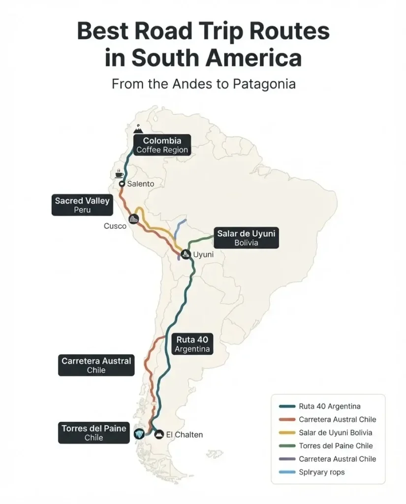
If there is one road in South America that deserves legendary status, it is Argentina’s Ruta 40. Stretching 5,194 kilometers from La Quiaca on the Bolivian border all the way down to Cabo Virgenes in Patagonia, it crosses 11 provinces and passes through landscapes that look completely different from one another. According to Argentina’s official tourism board, the route links everything from the wine valleys of Mendoza and the dramatic quebradas of Salta to the glacial steppes of Patagonia. You are not driving a single landscape. You are driving a country.
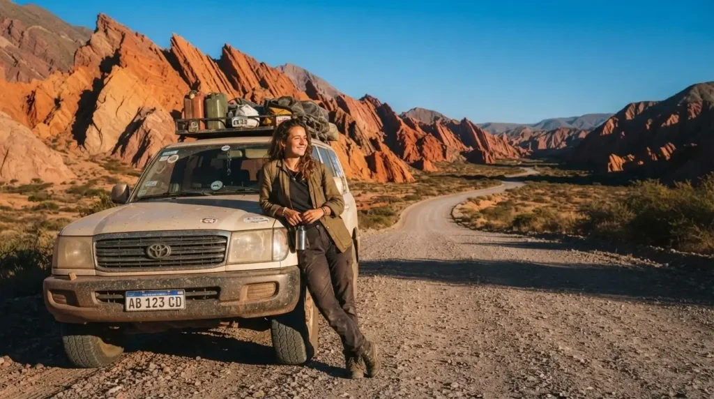
For first-timers, the northern section between Salta and Mendoza is the place to start. The stretch through Cafayate alone is worth the trip. This small town in the Calchaquies Valleys sits at around 1,700 meters and produces some of Argentina’s finest Torrontes wine, a crisp, aromatic white variety you will not find many other places in the world. The road between Salta and Cafayate cuts through the Quebrada de las Flechas, a corridor of tilted sandstone formations in burnt orange and red that look genuinely otherworldly, especially in late afternoon light. Pull over as often as you want. There is no rush.
For food on this stretch, eat empanadas at every opportunity. Argentine empanadas differ from what you might have tried elsewhere. They are typically baked, not fried, and each province has its own filling tradition. In Salta and Jujuy, you will find them stuffed with spiced beef, hard-boiled egg, and olive. Order half a dozen, sit down with a glass of local wine, and take your time.
Further south on Ruta 40, the Patagonian section is a different beast entirely. Distances are long, services are sparse, and you need a vehicle with a full tank and extra water before leaving any town. The reward is Perito Moreno Glacier near El Calafate, one of the few glaciers in the world that is not retreating, and El Chalten, a mountain village that serves as the trekking capital of Argentina. The full Ruta 40 from north to south takes three to four weeks minimum if you want to do it properly.
Best time to drive: October through April. The northern section is accessible year-round, but Patagonia in winter (June through August) brings severe cold, unpredictable weather, and closures on certain sections. Spring and early summer (October to December) give you longer daylight hours and relatively stable conditions.
The Carretera Austral, Chile: 1,200 Kilometers of Pure Patagonian Wilderness
If Ruta 40 is the road that defines Argentina, the Carretera Austral, Chile’s Route 7, is the road that defines Chilean Patagonia. It runs for more than 1,200 kilometers through territory so remote and so beautiful that simply being on it feels like an achievement. As Chile’s official tourism authority describes it, the route passes through lush native forests, imposing glaciers, crystalline rivers, and steep fjords, with some sections of the road accessible only by barge crossing.
The Carretera Austral begins in Puerto Montt and winds south through Hornopiren, Pumalin National Park, Chaiten, and La Junta before reaching Coyhaique, the largest city along the route and the best place to resupply. From Coyhaique it continues south to Puerto Rio Tranquilo, where the famous Marble Caves sit on the shore of General Carrera Lake. The caves are only accessible by boat and are one of the most genuinely remarkable natural formations I have heard described by travelers who have made this journey. The blue and turquoise patterns carved into the marble by thousands of years of water erosion are unlike anything else in the region.
The road ends at Villa O’Higgins, a tiny village at the literal end of the road. Beyond it, there is no more road. You either turn around or cross into Argentina on foot and horseback through the mountains, a route hikers use to connect to the Southern Patagonian Ice Field.
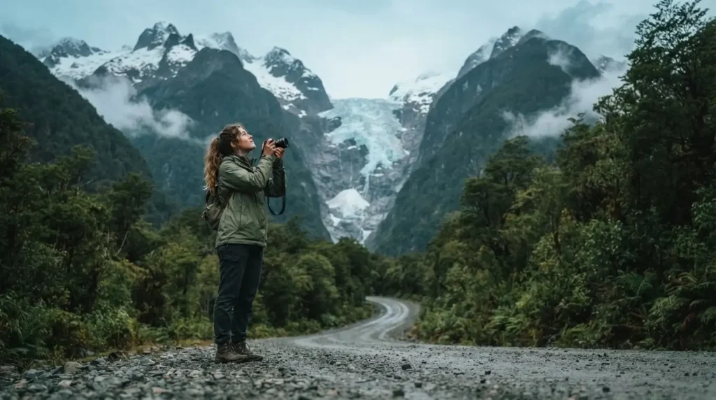
What makes the Carretera Austral particularly special for road trippers is the variety. You are not driving one type of landscape for days. One afternoon you are in a temperate rainforest so dense the canopy blocks the sky. The next morning you are looking at a hanging glacier spilling through a gap in the mountains. The Queulat Hanging Glacier, which appears to pour down between peaks like a frozen waterfall, is one of the most dramatic sights the route offers.
A practical note: a 4WD is strongly recommended for this road. Sections are gravel, some are deeply rutted in wet weather, and conditions can change quickly. A standard sedan will manage some stretches but will leave you stranded in others.
Rent a 4WD in Puerto Montt or Coyhaique and do not skip the extra insurance.
For food along the route, look for curanto whenever you are near the coast. It is a traditional Chilean dish from the Chiloe region that layers seafood, meat, potatoes, and vegetables, cooked over hot stones in a pit in the ground or, more commonly today, in a large pot. It is smoky, rich, and deeply satisfying after a long day on a gravel road. In Coyhaique, find a proper parrilla (grill restaurant) and order cordero al palo, whole lamb slow-roasted on a cross over an open fire. It is Patagonian cooking at its most elemental.
Best time to drive: November through March. Outside these months, sections of the road become difficult or impassable, and services close along the route. January and February are peak season, which means more company at campsites and slightly higher prices. If you go in November or March, you will have the road largely to yourself.
Salar de Uyuni and Southern Bolivia: A Landscape From Another Planet
To say the Salar de Uyuni is remarkable undersells it by a significant margin. It is the largest salt flat on earth, covering 10,582 square kilometers at 3,656 meters above sea level, and it sits within one of the most geologically extraordinary landscapes on the continent. As recognized by the International Union of Geological Sciences, the Uyuni salt flat holds a world-class deposit of evaporitic lithium and magnesium brines and represents one of the most significant geological heritage sites on the planet.
For road trippers, the most practical and rewarding way to experience this region is via the three-day jeep tour that departs from San Pedro de Atacama in northern Chile and ends in Uyuni, Bolivia. This route crosses the border from Chile into Bolivia on day one and covers far more than the salt flat itself. From what solo travelers and experienced South America road trippers consistently report, the surrounding landscapes, which include flamingo-filled colored lagoons, geysers at 5,000 meters elevation, volcanic rock deserts that look like Salvador Dali paintings, and a red algae-stained lake teeming with wildlife, are just as extraordinary as the salt flat and often more surprising.
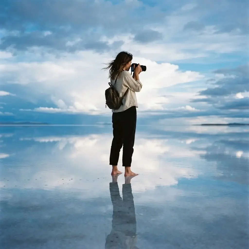
The mirror effect, those iconic photographs where the sky reflects perfectly in a thin layer of water on the salt surface, occurs during the wet season between January and March. Dry season (May through November) gives you the geometric hexagonal salt crust patterns and cleaner skies. Both are worth seeing. The choice depends on which photographs you want to come home with.
A few practical realities to plan around: the altitude is serious. The tour climbs from around 2,500 meters at the start to 5,000 meters at the Sol de Mañana Geysers on day one. Acclimatize for at least two days in San Pedro de Atacama before departing. Drink water constantly, avoid alcohol in the first days, and walk slowly. US citizens currently pay $160 USD for a tourist visa on arrival at the Bolivian border. Most other nationalities enter Bolivia visa-free for up to 90 days. Bring cash in both US dollars and Bolivian bolivianos because there are no ATMs on the route.
For food on this tour, your meals are typically included and prepared by your driver at basic lodges along the way. If you have time in San Pedro de Atacama before departure, eat at a local restaurant and try llajwa, a spicy Bolivian condiment made from tomato and the locoto pepper, which turns up on everything. In Uyuni town after the tour ends, find a simple local restaurant and order saltenas, a Bolivian baked pastry similar to an empanada but slightly sweet and filled with a spiced meat and broth mixture. They are served warm in the morning and are one of the great small pleasures of Bolivian street food.
Torres del Paine and Chilean Patagonia: The Road to the Edge of the World
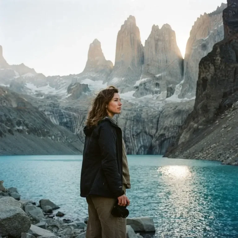
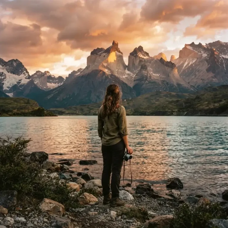
Torres del Paine National Park sits in the Magallanes region of southern Chile, and the drive to reach it is part of the experience. From Puerto Natales, the road covers roughly 150 kilometers on Ruta 9 Norte before entering the park. The park itself covers 227,298 hectares and was declared a UNESCO Biosphere Reserve in 1978. According to Chile’s national parks authority CONAF, the park is home to 17 distinct ecosystems, 126 bird species, and large populations of guanacos, pumas, condors, and the endangered huemul deer.
The drive from Punta Arenas to Puerto Natales is 250 kilometers on a paved road, and from there the road into the park runs another 150 kilometers. The approach road offers its own spectacle: flat Patagonian steppe stretching toward mountains that appear on the horizon as dramatic grey towers of granite. When the Torres themselves come into full view, rising 2,500 meters in near-vertical walls from the ice below, the visual impact is hard to describe in measured terms. You understand immediately why this place has the reputation it does.
One critical practical note for driving to Torres del Paine: there are no fuel stations inside the park or in the immediate surrounding area. Fill your tank completely in Puerto Natales before leaving. The park road is accessible for standard vehicles, but mountain roads in winter require snow tires or chains. From October through April, conditions are reasonable for most vehicles.
The food culture in Puerto Natales and the Magallanes region centers on centolla, the giant Patagonian king crab. If you pass through Puerto Natales, order it simply prepared, steamed or grilled with lemon and butter, at a local restaurant near the waterfront. It is the kind of meal that you think about for years afterward. The region also produces exceptional lamb, grazed on open steppe and roasted slowly over open fires in the Patagonian tradition.
Colombia’s Coffee Region: A Road Trip Through Living Cultural History
Not every great South America road trip belongs to Patagonia. Colombia’s Eje Cafetero, the coffee-growing axis in the Andean foothills, is one of the most culturally rich and visually beautiful road trips on the continent. The region was designated a UNESCO World Heritage Site in 2011 as the Coffee Cultural Landscape of Colombia, recognized for its extraordinary example of continuing land use in which generations of campesino families created innovative management practices on extraordinarily challenging terrain.
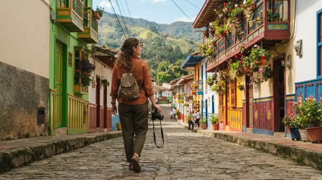
The road trip core connects the cities of Manizales, Pereira, and Armenia, with smaller towns like Salento, Filandia, and Jardin as the highlight stops. Salento is the most visited town in the region and for good reason: its streets are lined with brightly painted colonial buildings, the local people are warm and genuinely welcoming, and the Cocora Valley sits just a 20-minute jeep ride away. The valley is famous for the wax palms, Colombia’s national tree, which grow to heights of 60 meters and stand above the cloud forest in clusters that look both prehistoric and surreal.
The roads between towns are narrow, winding, and scenic in the way that mountain roads through active farmland always are. You pass coffee plantations at every elevation. Many farms offer tours and tasting sessions; joining one is not optional if you want to understand what makes this region special. Colombian coffee, particularly from the Nariño and Huila regions nearby, is some of the finest in the world. Drinking a cup at the farm where the beans were grown, overlooking the valley, is a travel experience that holds its own against any glacier or salt flat.
For food in the Eje Cafetero, the traditional dish is bandeja paisa, a heaped plate from the Antioquia region that includes grilled steak, chicharron (fried pork belly), red beans, white rice, sweet plantain, chorizo, an arepa, a fried egg, and avocado. It is enormous, it is delicious, and it tells you something real about the culture that produced it. The food here is generous in the same way the people are.
The roads in this region are well-maintained and a standard vehicle handles them easily. The main driving challenge is the mountain grades and the occasional section where lanes narrow to a single width around a blind curve. Drive carefully and take your time.
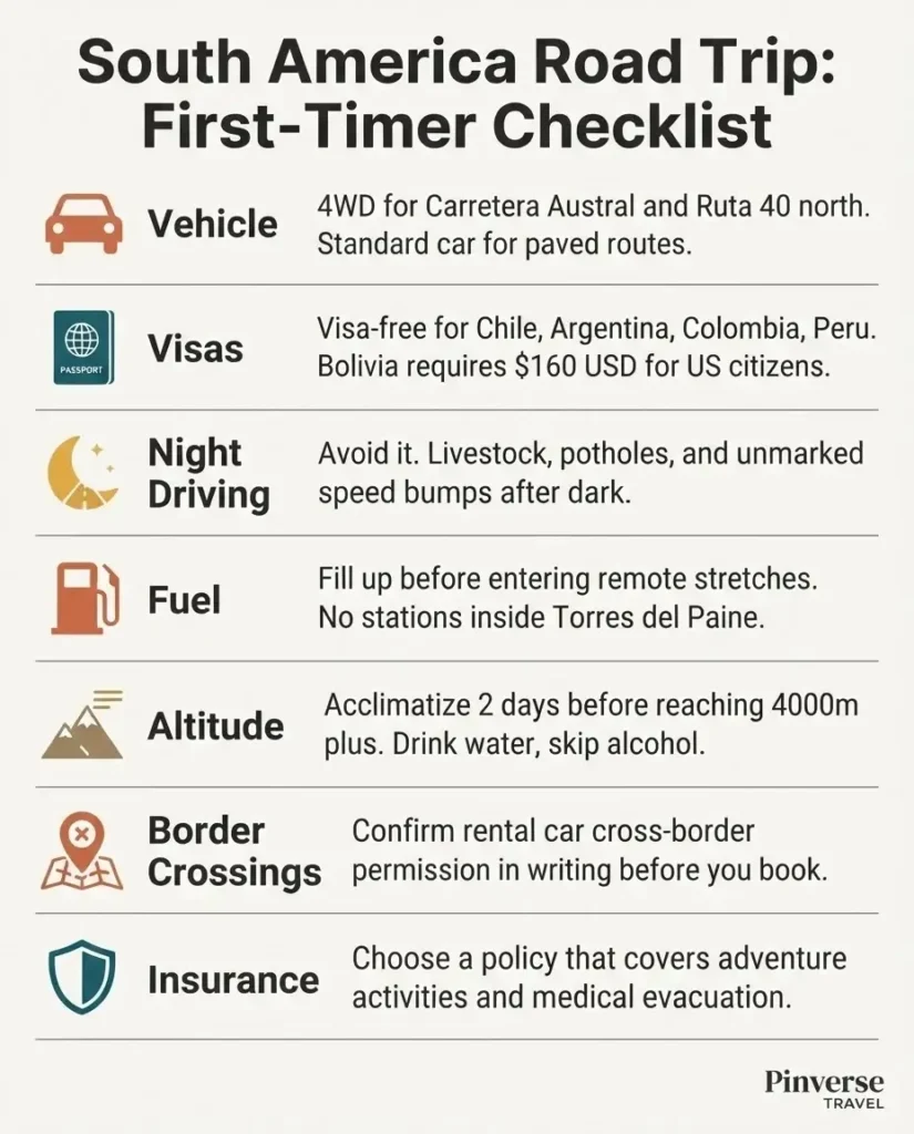
Practical Planning: What Every First-Timer Needs to Know
Road tripping South America is genuinely doable for first-timers. But there are a few realities worth understanding before you go.
On driving at night: avoid it everywhere on the continent. Roads are poorly lit, livestock wander onto the tarmac without warning, and speed bumps called lomos de burro often appear without markings. As experienced South America road trippers consistently note, according to resources like Escaped Travel’s driving guide for South America, keeping your eyes on the road surface and restricting driving to daylight hours are among the most important safety habits to develop on this continent.
On rental cars and border crossings: most rental agencies will not allow cross-border driving without written authorization arranged in advance. If you are planning a multi-country route, confirm this with your rental company before booking. Some travellers planning extended overland journeys choose to buy a used vehicle in Santiago or Buenos Aires, drive it for the duration of the trip, and resell it before flying home. This requires more planning but gives you maximum freedom.
On visas: US, UK, Canadian, and Australian passport holders travel visa-free to Argentina, Chile, Colombia, and Peru for up to 90 days each. Bolivia is the exception: US citizens currently pay $160 USD for a tourist visa on arrival. Check current advisories for Colombia, where the US Department of State maintains an up-to-date travel advisory page with the latest entry requirements and regional safety information.
On altitude: if your route includes Bolivia, the Atacama, or the higher sections of the Andes, take altitude seriously. Plan at least two days of acclimatization at moderate elevation before climbing higher. Drink water consistently, avoid alcohol during the adjustment period, and recognize the symptoms of altitude sickness early: headache, fatigue, nausea, and shortness of breath. Walk slowly and give your body the time it needs.
On vehicle choice: the Carretera Austral and Ruta 40’s northern gravel sections genuinely require a 4WD. The Colombia Coffee Region, Peru’s Sacred Valley road, and the paved sections of Ruta 40 through Mendoza and Patagonia can be driven in a standard vehicle. Be honest about your route and rent accordingly.
A Note on the Pace
If there is one mistake that people new to South America road trips consistently make, it is trying to cover too much. The continent rewards slow travelers. A week in one region will give you ten times more than a week trying to hit six. Pick one or two of the routes above for a first trip, drive them without rushing, eat the local food, talk to people, and let the unexpected moments happen.
The best road trips I have ever planned or heard described have rarely been about the destinations ticked off. They have been about the conversations that happened when the car broke down, the sunset that appeared around a corner nobody saw coming, and the meal shared with strangers at a roadside restaurant with no menu and no English spoken. That is the South America that stays with you.
Whatever route you choose, start planning now. The perfect time to go does not exist. The roads are waiting.